JULY 2017
I have decided that I am going to abandon further progress on this website, because although I have figured out a browser that will accommodate page updates, but it is not user friendly at all, and creates more of a problem trying to combine links with traditional typing. What I used to accomplish in several hours of work now takes days.
Additionally, I have discovered that I have reached my maximum file storage quota, and adding additional space means upgrading. I refuse to pay more for a service that is worse than it used to be, so as I suspected earlier this year, you are seeing the freezing of West Houston Archives, the website. I no longer have the desire to work on the pages under the existing conditions and terms, and I ultimately have to give the webhost two thumbs down in terms of capabilities. If you ever wish to expand your website, this is not the place to do it. I will continue to update the Facebook page periodically, but have not posted anything recently due to a lack of time.
AUGUST 2016
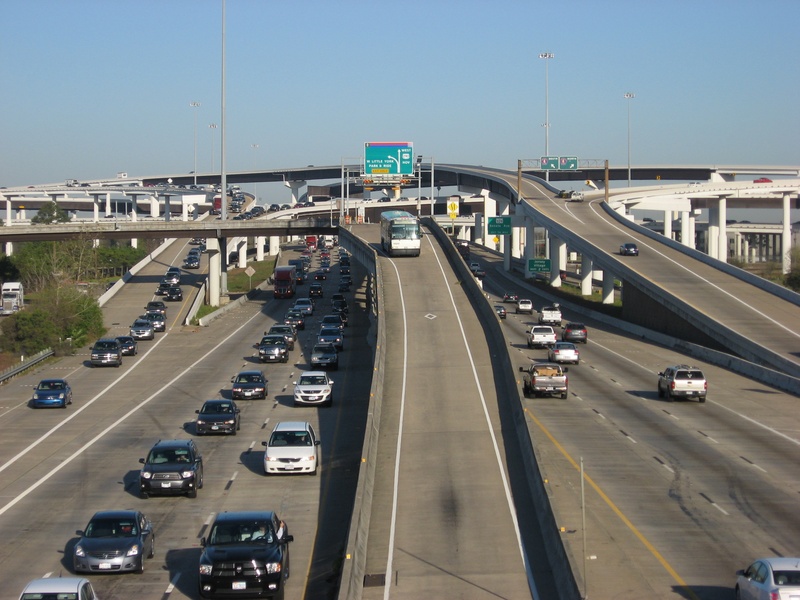
*Updates to the 290 Freeway page have been added, including mostly the outer Beltway Cy-Fair area, as well as some shots from the stretch of 290 between the Beltway and Loop 610.
JUNE 2016
*More aerial photographs have been added, covering parts of FM 1960, Eldridge and State Highway 6 during the Tax Day floods of April 18th, the 290 Freeway, The Katy Freeway, and Grand Parkway. Each of these pages will have some new additions.
*Historic Town Sites page has added a table of contents, as well as some updates to the text for towns such as Louetta, Westfield, Satsuma, and Jeanetta.
*Thanks to some help from a local resident who enjoyed the content of the website, I now have digital copies of old Zingery survey maps, which have been a tremendous aid in deciphering some of the history of the Houston area.
*The Satsuma portion of the Historic Town Sites page has received significant changes not only to the text, but a lot of images have been added.
FEBRUARY 2016
*Updates to the 290 page have been made, showing October 2015-February 2016. Mostly involving chapters near and outside the Beltway.
*Grand Parkway page has been updated with photos from late 2015, as well as early 2016 when Parkway was opened to traffic.
*Abandoned/Realigned roads page has been updated to include Barker-Cypress Rd., and Gertie Rice Farm Rd. in West Houston. No photos yet but coming soon.
*A new chapter has been added to the 290 page for anything west of Hockley. So far I have a few aerial photos but there will be more posted in a year or two.
*Photos have been added to the Telge Rd. chapter of the "Other Historic Roads" page. *Note: There is an expansion project in play to widen Telge from Spring Cypress to FM 2920.
OCTOBER 2015
*Louetta Rd. added to the list of roads on "Other Historic Roads" page. Coverage is still limited but the chapter has been started.
*Photographs of the exterior of the Wunsche Bros. Cafe in historic Old Town Spring following a 2015 fire have been added to the "Spring" chapter of the Town Sites page.
*New photographs have been added to the Grand Parkway page under the Segment F2 chapter. Mostly involving Boudreaux Rd. and the segment of Grand Parkway between 249 and FM 2920.
*Photographs of the future Towne Lake shopping center and boat marina off Barker-Cypress Rd. and Tuckerton have been added to the Barker-Cypress page of "Other Historic Roads".
*Various photographs added to many chapters of the 290 page, covering July-September of 2015.
SEPTEMBER 2015
*New photos of the Matzke home at Highway 6 & West Little York have been published (sorry, just the exterior), and the related text has been improved upon due to some recent sharpening of facts about the property.
AUGUST 2015
*Abandoned Roads page updated with three more chapters. West Belt Dr., Roark Rd., and Hayes Rd. West Belt and Roark were overtaken by the construction of the West Sam Houston Tollway, and Hayes Rd. is another dead end stump of a road that was left behind after the birth of Wilcrest Dr.
JUNE 2015
*290 FREEWAY page has been updated with new photos from March through May, at various intersections.
*SH-249 page has been updated with photos of the newly opened Tomball Tollway.
*FM 1960 page has been updated to include the new Tom's Boat under construction at Bobcat Rd.
*Abandoned & Realigned Roads page has been updated with 16 new photos on the Lou Edd Rd. chapter, including mention of Flying Acres, a residential airstrip.
*Abandoned & Realigned Roads page has been updated with 8 new photos on the Addicks-Fairbanks Rd. chapter, featuring the floods from May 2015.
*Abandoned & Realigned Roads page has been updated with 5 new photos on the Patterson Rd. chapter following the floods from May 2015.
*Grand Parkway page has been updated with 6 new photos on the F2 Segment chapter.
________________________________________________________________________________________________________________________________________________