The West Houston Archives
Discover the history of West Houston from its many roads
INTRODUCTION
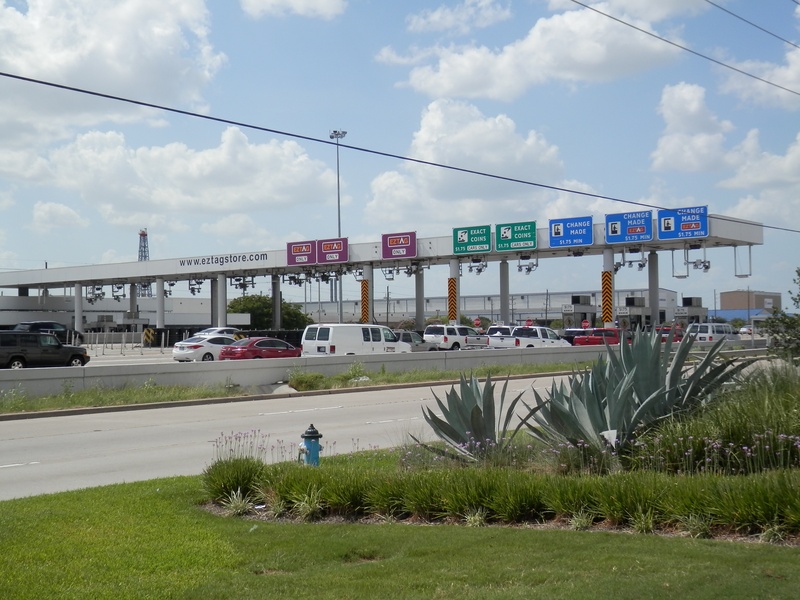
(Above photo: The Sam Houston Tollway toll plaza near West Little York and US 290, July 2014)
It began on the west side of Harris County with a surface road known as West Belt Dr., which resembled an early freeway in its infancy; two frontage roads divided by a wide grass median. Over the Houston Ship Channel, the first section of the toll road, a bridge, was completed and opened in 1982 by the now defunct Texas Turnpike Authority (TTA). However, the remainder of the Beltway 8 road was never improved. The TTA voted against upgrading the road to freeway standards, leaving Harris County to foot the bill for such an undertaking.
Harris County could not afford to construct and maintain another freeway at the time, but in 1983, voters approved a referendum to release up to $900 million in bonds to construct both the Sam Houston Tollway, and the Hardy Toll Road. The Sam Houston Tollway would be the main lanes of the beltway, which, in the early 1980's, was still just divided frontage roads. Harris County created the HCTRA (Harris County Toll Road Authority) shortly after the referendum to oversee the construction of the new tollway, and manage the revenue generated by tolls to upgrade and maintain the freeway. Throughout the 1980's, construction on the main lanes of the Sam Houston Tollway took place on the west side of town, slowly overtaking the old West Belt Dr. In 1988, the Beltway 8/Interstate 10 interchange was completed, and a ceremony was held in 1989 to commemorate the opening of the tollway main lanes between I-10 and US 290.
In July of 1990, the section of the tollway between US 290 and I-45 was opened, right on schedule and millions under budget. Over the next two decades, the Beltway 8 loop would be gradually completed, piece by piece. The last segment to be completed was the stretch between Interstate 69 (US-59) and the Crosby Freeway , in 2011.
SOME INTERESTING FACTS ABOUT BELTWAY 8
* Just north of US 290, you may notice that the main lanes of Beltway 8 skirt around the city of Jersey Village. This was not part of the original road plan. During the planning stages of the tollway's construction, the city of Jersey Village would have been pierced by the path of the new beltway. Community residents strongly opposed the passing of a freeway through the heart of their residential community, and ultimately it was decided that the new tollway main lanes would go around Jersey Village, rather than going through it. This is why the path of Beltway 8 north of 290 makes such a radical turn to the east, then west again.
* In 1989 during the opening ceremony for the newly completed segment of the tollway from I-10 to US 290, the Bangles performed at the event.
* There are no surviving signs of the old West Belt Dr. in Houston, but there is a road sign for a fire station along the frontage road south of the toll plaza that gives the address as West Belt Drive. The only other vestige of the pre-tollway days is a stretch of the old North Belt Dr. that was left behind after completion of the main lanes in the late 1980's. (way up on the northeast side of town) Just east of Interstate 69 (US-59), there is a segment of the old divided road that dips south of the present-day freeway. It is named Old North Belt Drive, so it isn't hard to find. The road is covered in more detail on my abandoned/realigned roads page.
* South of Memorial Dr., the tollway right of way cut right through an existing neighborhood, creating several dead ends on Figaro and Traviata St. This is easy to miss while driving along the frontage roads, but residents of Figaro and Traviata who lived there before the construction of the tollway might have a different story to tell about their neighborhood. The street known as Boheme Dr. was left open, and is now the point in which the southbound frontage road briefly ends, and transitions to the east side of the freeway for some distance. This complicated and confusing arrangement is probably the best working scenario that HCTRA could come up with to result in minimal impact on the nearby neighborhoods. To this day, the design has yet to be improved upon.
_________________________________________________________________________________________________________________________________________________
GALLERY
Album 24 Pic 08.jpg : The I-10 and Beltway 8 interchange under construction, facing south along the beltway, in 1988.
Album 24 Pic 09.jpg : Beltway 8 westbound frontage road approaching SH-249, Feb. 2010.
Album 24 Pic 10.jpg : Beltway 8 westbound frontage road approaching SH-249, facing Shell station, Feb. 2010.
Album 24 Pic 17.jpg : Staybridge Suites along Beltway 8 near Gessner, Feb. 2010.
Album 24 Pic 18.jpg : University of Phoenix along Beltway 8 near Gessner, Feb. 2010.
Album 24 Pic 19.jpg : Westbound on Beltway 8 frontage road, somewhere east of Gessner, Feb. 2010.
Album 24 Pic 25.jpg : Southbound on West Beltway 8 approaching the Westpark Tollway and Harwin, Sept. 2011.
Album 24 Pic 26.jpg : Southbound on West Beltway 8 near Richmond Rd., approaching a cluster of office buildings including the Millennium Tower (the one with the curved roof), which was completed in 1982.
Jul 2014a 040.JPG : Beltway 8 at Hardy Toll Road interchange, facing south across Beltway 8, July 2014.
Jul 2014a 041.JPG : Beltway 8 at Hardy Toll Road interchange, facing the northeast corner, July 2014.
Jul 2014a 043.JPG : Eastbound on Beltway 8 approaching the US-59/Interstate 69 interchange, July 2014.
Jul 2014a 067.JPG : Figaro St., one of the streets in Memorial Bend community that was cut in half by the Beltway 8 construction during the 1980's. You can tell by the abrupt end of the street into a wall that this was not the intended way for the street to end. July 2014.
Jul 2014a 068.JPG : Boheme Dr., facing west across Beltway 8 from one side of Memorial Bend to the other, July 2014.
Jul 2014a 069.JPG : Boheme Dr. and Beltway 8 frontage road intersection in Memorial Bend community, July 2014.
AERIAL PHOTOS OF THE WEST BELTWAY, APRIL 2016
Apr 2016a 007.JPG : Flying south along the Beltway corridor near the toll plaza by West Little York. The Addicks Reservoir can be seen in the distance.
Apr 2016a 008.JPG : The Beltway 8 at Clay Rd., facing west along Clay.
Apr 2016a 009.JPG : The Beltway 8 and I-10 interchange.
Apr 2016a 010.JPG : Just south of I-10, where the Beltway goes below ground level at Memorial and Boheme Dr.
Apr 2016a 011.JPG : The Beltway at Briar Forest.
Apr 2016a 012.JPG : The Beltway at Westheimer Rd.
Apr 2016a 013.JPG : The Beltway at the Westpark Tollway interchange.
Apr 2016a 014.JPG : The Halliburton complex located off the Beltway and Bellaire Blvd. This modern looking structure began as the Brown & Root HQ during the early 1980's oil boom.
Apr 2016a 022.jpg : The Beltway 8 and I-10 interchange, facing north along the Beltway.
__________________________________________________________________________________________________________________________________________________