The West Houston Archives
Discover the history of West Houston from its many roads
INTRODUCTION
(Above photo: I-10 West, or the Katy Freeway, facing west from the 610 Loop, January 2014)
Interstate 10 is the southernmost interstate highway in the United States, running from the east coast to the west coast, with more than a third of its length residing within the boundaries of Texas. The interstate was part of the original 1956 interstate highway system design, and was completed in 1990. The interstate runs through the middle of Houston, almost perfectly bisecting the city into north and south.
In Houston, I-10 is either referred to as the Katy Freeway, or the East Freeway, depending on which side of downtown you are on. The East Freeway passes through Beaumont, Tx., continuing on to Louisiana, and the Katy Freeway runs through the town of Katy, and on to San Antonio. Prior to its designation as Interstate 10, the original east/west right of way was known as US Highway 90 through Houston. US-90 still exists, technically, but it has been absorbed by I-10, until you get to downtown Katy, where I-10 curves off to the south past Katy Mills Mall. From that curve, US-90 continues due west, paralleling the old railroad right-of-way through the heart of Katy.
Going back even further into history, US-90 was not the original road cutting west through the center of West Houston. As far back as the late 19th century, there was Katy Rd., just another narrow road like any other in Houston that led from one town site to another. Katy Rd. followed the railroad right-of-way, and was eventually made into a paved asphalt configuration. Eventually, US-90 came through the area, superseding Katy Rd., which was redesignated "Old Katy Rd."
For many Houston residents born after the 1970's, Old Katy Rd. was just an alternate route to I-10, a side street; but it was once the primary route to Katy. After the 2008 expansion of Interstate 10 was completed, most of Old Katy Rd. was consumed in the process. Only a few signs near the 610 Loop and Hempstead Rd. interchanges mark its presence today, and there is a very small segment of Old Katy Rd. still intact, on the northeast corner of I-10 and State Highway 6.
In 2002, the railroad right-of-way running just north of I-10 was demolished, and over the next several years, construction began on the widening of the Katy Freeway from its original 6-8 lane configuration to approximately 16 lanes. The first sections of the completed freeway opened in 2006, and it was finished in 2008, with the addition of the Katy Toll Road in the center of the freeway.
Today, the Katy freeway is the widest and most efficient freeway in the Houston Freeway system, and has set the standards for which all future freeway expansions will be done.
________________________________________________________________________________________________________________________________________________
PHOTOS FROM 2006
The following series of photographs were taken during March of 2006 from a moving vehicle, westbound on I-10 during the widening project.
Dec 2005 003.jpg : I-10 at State Highway 6 during construction, Dec. 2005. This is still the original way the intersection looked, with SH-6 dipping below I-10, as well as the railroad bridge.
Mar 2006 007.jpg : I-10 Westbound at Bingle & Voss exit ramp.
Mar 2006 008.jpg : I-10 Westbound at Campbell Rd. exit ramp.
Mar 2006 009.jpg : I-10 Westbound approaching Beltway 8 interchange (the original 1988 configuration)
Mar 2006 010.jpg : I-10 Westbound approaching Beltway 8 interchange/view of frontage road
Mar 2006 011.jpg : I-10 Westbound near Dairy-Ashford Rd. exit, with view of Old Katy Rd. on the right.
Mar 2006 012.jpg : I-10 Westbound near Eldridge Parkway overpass during reconfiguration of the intersection below.
Mar 2006 013.jpg : I-10 Westbound over Eldridge Parkway, facing the Omni Hotel (formerly the Hyatt Regency)
Mar 2006 014.jpg : I-10 Westbound on frontage road approaching SH-6 intersection before overpass existed.
Oct 2006 022.jpg : SH-6 just south of I-10, prior to reconfiguration of the intersection.
__________________________________________________________________________________________________________________________________________________
OTHER PHOTOS ALONG I-10
Aug 2010 002.jpg : The view from the new Beltway 8/I-10 interchange, heading onto I-10 east, with the Memorial Hermann tower in view, Aug. 2010.
Aug 2010 003.jpg : Another photo taken from the flyover ramp to I-10 east, Aug. 2010
Nov 2011 011.jpg : The Memorial Hermann tower on I-10 at Gessner, Nov. 2011
Located near the intersection of I-10 West and Beltway 8 is this familiar structure that has stood for many decades. It looks to have been some type of rice drier or industrial plant, possibly from the postwar era, but is currently being used as a storage facility.
Nov 2011 012.jpg : Photo from November 2011
Nov 2011 013.jpg : Photo from November 2011
Nov 2011 014.jpg : Photo from November 2011
Aug 2012a 135.jpg : The Memorial Hermann tower at I-10 & Gessner, Aug. 2012
Aug 2012a 134.jpg : I-10, facing east from Gessner, Aug. 2012
Sep 2012a 059.jpg : I-10 at Post Oak Dr., facing west from the beginning of the new Katy Toll Road, Sep. 2012
Sep 2012a 060.jpg : Westbound on I-10 frontage road near Silber, Marqe Entertainment Center, Sep. 2012
Sep 2012a 061.jpg : IKEA Swedish furniture store on I-10 near Voss, Sep. 2012.
Sep 2012a 062.jpg : IKEA sign on I-10. Originally, the place opened under the name "STOR" before it was IKEA.
Sep 2012a 063.jpg : Westbound on I-10 at the Campbell Rd. exit, Sep. 2012
Sep 2012a 064.jpg : Westbound on I-10 at the Bunker Hill Rd. exit, Sep. 2012
Sep 2012a 065.jpg : Westbound on I-10 at the Gessner Rd. exit, Sep. 2012
Sep 2012a 068.jpg : Westbound on I-10 at the Dairy-Ashford Rd. exit, Sep. 2012
Sep 2012a 070.jpg : Westbound on I-10 passing Westside Lexus near Dairy-Ashford, Sep. 2012
Sep 2012a 071.jpg : Westbound on I-10 at Eldridge Parkway exit, Sep. 2012
Sep 2012a 072.jpg : Intersection of I-10 and Fry Rd., facing northwest from Fry Rd., Sep. 2012
Sep 2012a 076.jpg : I-10 West and Grand Parkway SH-99 interchange under construction, Sep. 2012
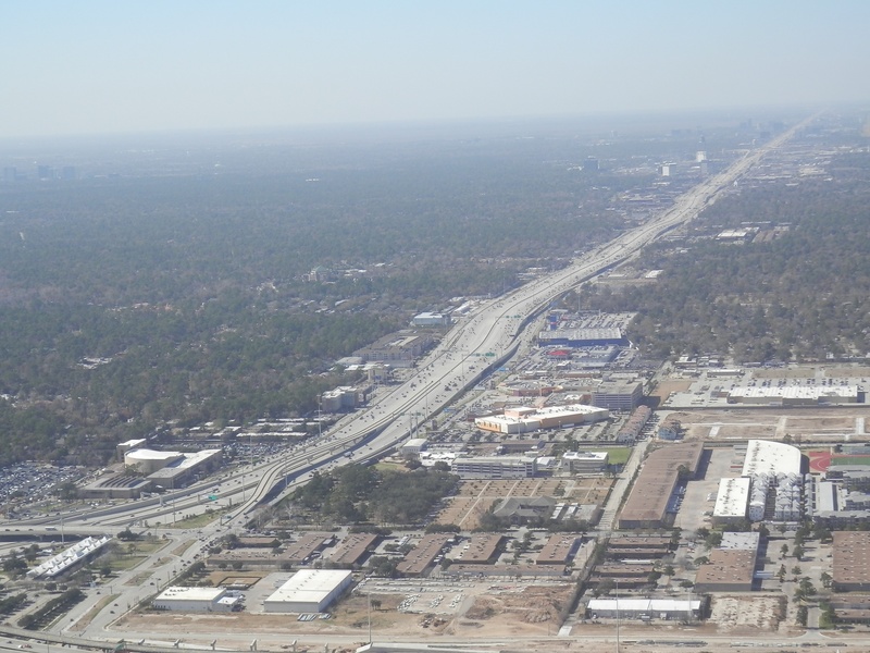
Aug 2013a 087.jpg : Aerial view of I-10, facing west from Post Oak while flying over 610 Loop, Aug. 2013.
Aug 2013a 088.jpg : Aerial view of Memorial Hermann Hospital at I-10 & Gessner, Aug. 2013.
Aug 2013a 089.jpg : Aerial zoom-in photo of Memorial Hermann tower with Gessner in the distance, Aug. 2013.
Aug 2013a 091.jpg : Aerial photo of the old rice driers (now public storage) on Westview near Beltway 8, Aug. 2013.
Aug 2013a 092.jpg : Aerial photo of I-10 and Beltway 8 interchange, facing northeast, Aug. 2013.
Aug 2013a 093.jpg : Aerial photo of Dairy-Ashford & Eldridge Parkway near I-10, Aug. 2013.
Aug 2013a 094.jpg : Aerial photo of new office building under construction, I-10 & Eldridge, Aug. 2013.
Aug 2013a 096.jpg : Aerial photo of I-10 and State Highway 6, facing north into Addicks Reservoir, Aug. 2013.
Aug 2013a 097.jpg : Aerial photo of I-10 and State Highway 6, facing north along SH-6, Aug. 2013.
Aug 2013a 098.jpg : Aerial photo of I-10 and Barker Cypress, Aug. 2013. Notice the older access road on the south side that was once part of the original intersection design. Before the Katy Freeway expansion, Barker Cypress passed over I-10 instead of beneath it.
Jan 2015a 052.JPG : Aerial photo: I-10 facing east over central Katy, with US-90 on the right. In the distance is Grand Parkway and Katy Mills Mall, Jan. 2015.
Jan 2015a 053.JPG : Aerial photo: I-10 over central Katy, where I-10 merges with the old US-90 corridor, Jan. 2015.
Jan 2015a 054.JPG : Aerial photo of Katy Mills Mall, Jan. 2015.
Jan 2015a 055.JPG : Aerial photo of Katy Mills Mall, Jan. 2015.
Jan 2015a 056.JPG : Aerial photo: Facing east along the I-10 corridor with Grand Parkway at the bottom of the photo, Jan. 2015.
APRIL 2016
Apr 2016a 009.JPG : Aerial photo of the I-10 and Beltway 8 interchange. The view is traveling south along the Beltway corridor facing out west.
Apr 2016a 020.jpg : Aerial photo of the Memorial Hermann hospital at I-10 & Gessner,
Apr 2016a 021.jpg : Aerial photo of the Memorial Hermann hospital at I-10 & Gessner,
Apr 2016a 022.jpg : The I-10 and Beltway 8 interchange, facing north along Beltway 8.
Apr 2016a 023.JPG : Aerial photo of I-10 at Eldridge Parkway, facing north on Eldridge.
Apr 2016a 024.JPG : Aerial photo of I-10 at State Highway 6 (formerly Addicks-Satsuma Rd.).
Apr 2016a 025.jpg : Aerial photo of I-10 at Barker-Cypress Rd., facing north on Barker-Cypress. *Notice the arc-shaped access road that was once part of the original intersection design.
Apr 2016a 026.jpg : Aerial photo of I-10 at Fry Rd., facing north on Fry.
Apr 2016a 027.jpg : Aerial photo of I-10 at Mason Rd., facing north on Mason.
Apr 2016a 028.jpg : Aerial photo of I-10 at Grand Parkway, facing east along I-10. This is one of my favorite photos I've taken with a smart phone!
May 2016a 049.JPG : Aerial photo of the Katy Cinemark Theaters at I-10 and Grand Parkway. (Actually from early May 2016).
_______________________________________________________________________________________________________________________________________________