The West Houston Archives
Discover the history of West Houston from its many roads
INTRODUCTION
One of my favorite things to research and document in West Houston is its vast amount of realigned, abandoned, and forgotten roads. As long as Houston and its surrounding areas have been growing and expanding, the road plans have changed with it. As with any city that experiences major growth, sometimes the roads originally put in place become antiquated, or incapable of handling the increased volumes of traffic that come with that growth.
Back when most of Harris County's roads were originally established in the late 19th and early 20th century, they were required to respect the boundaries of private land owners. The property lines for much of what is now West Houston were drawn out in squares and rectangles, for the most part. The first roads, which were little more than dirt paths or pulverized oyster shell paving, were laid out in 90 degree turns all over the county. Roads would make these sharp turns to skirt around property lines, and it resulted in a very inefficient way to get from place to place.
As long as the area remained rural with little traffic, this was not a problem. However, as new communities and commercial developments began reaching out into the west and northwest parts of Harris County, some serious changes had to be made to improve the existing road infrastructure. Rather than politely going around property lines, TxDOT preferred the method of buying out sections of land from land owners to build the roads wherever they needed them to go. This allowed newer roads to be smoother and wider with higher speed limits. It eliminated congestion and excessive turns, as well as offsets (often seen in rural areas where a road ends, and then resumes several yards or blocks down the road).
In many cases, these realignment or expansion projects would leave behind a section of the original road that no longer fit the modified design. Sometimes these orphan segments were abandoned and left for mother nature to reclaim; other times the old road would be kept open to provide access to nearby residential or commercial interests that were in place before the realignment. I like to seek out these old portions of road to see a small sliver of history that managed to survive the times. While some are more preserved than others, all of them seem to tell the story of settlement in West Houston in their own way.
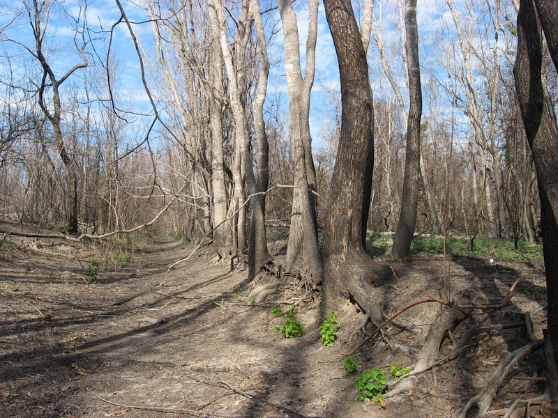
I first learned about these ghost alignments in 2011 while trying to find out the story behind a small stretch of road in Addicks Reservoir that ran into the forest near the intersection of Eldridge Parkway and Patterson Rd. I learned that it was actually a remaining section of Addicks-Fairbanks Rd., a two lane rural road that pre-dated Eldridge Parkway. The newer parkway was built over the original road, but smoothed out to avoid a sharp turn near an old cemetery. The newer parkway became the normal route for traffic, and the old corner of road was closed off on both ends. Using websites like NETR Online (Historicaerials.com) and Google Earth, I confirmed this discovery, and went on to discover many more locations where roads had been realigned, leaving behind old segments of road.
The roads I have covered are listed on this page alphabetically. In the case of Farm-to-Market roads, I used their alternate name to fit them in alphabetical order. (FM529=Spencer Rd). I can safely say I have not found every single realignment in the city, but I think I've found the majority of them, at least the ones that still contain evidence of the original alignment.
________________________________________________________________________________________________________________________________________________
TABLE OF CONTENTS
The roads on this page are listed alphabetically as follows. Sorry I don't have clickable links yet on these names to make searching easier, but I am working on the solution.
Addicks-Clodine Rd.
Addicks-Fairbanks Rd. (Eldridge Parkway)
Addicks-Howell Rd.
Addicks-Satsuma Rd. (Main Road)
Addicks-Satsuma Rd. (Abandoned South Mayde Creek Bridges)
Aldine-Westfield Rd.
Alief-Clodine Rd.
Bammel-North Houston Rd.
Barker-Clodine Rd.
Barker-Cypress Rd.
Bauer Rd.
Boudreaux Rd.
Cameron Rd.
Clay Rd.
Cutten Rd.
Cypress-North Houston Rd.
Cypress-Rosehill Rd.
Dairy-Ashford Rd.
Duncan Rd. (Hollister Rd.)
Fairbanks-North Houston Rd.
Fry Rd.
Goar Rd. (Briar Forest Dr.)
Gertie Rice Farm Rd. (Kieth-Harrow/Windsong Trail)
Greenhouse Rd.
Hayes Rd.
Hillcrest Dr.
Hiltonview Rd.
Holzwarth Rd.
House & Hahl Rd.
Huffmeister Rd.
Jackrabbit Rd.
Katy Rd.
Kluge Rd.
Kuykendahl Rd.
Lamb Rd.
Lauder Rd.
Lou Edd Rd.
Louetta Rd.
Mangum Rd.
W. Montgomery Rd. (FM 149/SH 249)
Noble Rd.
North Belt Dr.
North Houston-Rosslyn Rd.
North Shepherd Dr.
Perry Rd.
Roark Rd.
Spencer Rd. (FM 529)
Spring-Cypress Rd.
Stockdick School Rd.
Susquehannah Dr.
Telge Rd.
Texas Western Narrow Gauge Railroad
Waller-Tomball Rd. (FM 2920)
West Belt Dr.
_______________________________________________________________________________________________
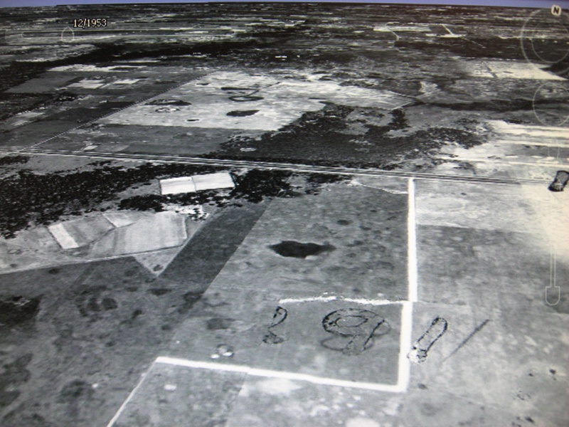
ADDICKS-CLODINE RD.
(Above photo: The barely recognizable alignment for Addicks-Clodine Rd., just north of Westheimer Parkway, Dec. 2011)
The text for this chapter has been temporarily suspended for review based on some new information that has required revision of this subject.
Accessing the road from IH-10
ACR 005.jpg : The drivable portion of the road leading to the dam, facing north towards I-10.
ACR 006.jpg : Facing south from the Barker Dam near I-10 towards the abandoned section.
Accessing the road from Westheimer Parkway in George Bush Park
ACR 008.jpg : Entering the abandoned section from Westheimer Pkwy. This gravel path is located inside a gate, and quickly veers to the east into a bald spot. This is not the old road. To access the abandoned road from this point, you must hike due north from this access point into a straight line of trees to find the old right-of-way.
ACR 012.jpg : The line of old trees along the west shoulder marking the old right-of-way, facing north.
ACR 013.jpg : The central path of Addicks-Clodine, facing north near George Bush Park.
ACR 014.jpg : Discarded tires along the side of Addicks-Clodine, appear to be 40+ years old.
ACR 015.jpg : A view of the access point from George Bush Park along Westheimer Parkway, facing north while standing on what used to be the old right-of-way. This section is part of the park area, and is well maintained & sodded.
ACR 016.jpg : Facing south from the same spot. This is the southernmost portion of abandoned road and ultimately leads to the southern part of Barker Dam.
Accessing the road from the Noble Hiking Trail (near SH-6 and Briar Forest Dr.)
ACR 023.jpg : The abandoned road, facing south from the Noble Hiking Trail.
ACR 025.jpg : A discarded cylinder head from a Chevy small block V8 engine.
ACR 026.jpg : An old a/c compressor from a 1960's General Motors car.
ACR 027.jpg : An old carburetor I found half buried in dirt. 1960's/1970's era.
ACR 028.jpg : Discarded water flow meter. (Armco Model 101, used during the 1920's).
ACR 017.jpg : The intersection of Westheimer Rd. and Addicks-Clodine, facing south from the dam. This is where the active section of Addicks-Clodine begins, serving a residential area.
______________________________________________________________________________________________________________________________________________
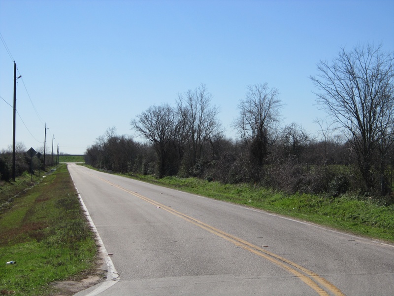
ADDICKS-FAIRBANKS RD.
(Above photo: Facing west along part of the old Addicks-Fairbanks alignment that was bypassed in 1982)
Addicks-Fairbanks Road is the predecessor to what is now Eldridge Parkway. While Eldridge currently extends south of IH-10 and north of FM 529 clear into Cypress, the original road only ran between IH-10 and FM 529, and dates back to the early 20th century when the town of Addicks was still at its original location inside the reservoir.
Around 1982, Addicks-Fairbanks Road was overtaken by Eldridge Parkway, and the sharp turn just north of Patterson Rd. was bypassed by a smoother curve that runs along the eastern edge of Bear Creek Pioneers Park. Old Addicks-Fairbanks was not only inefficient, but susceptible to major flooding after creation of the Addicks Reservoir. Even after moderate rainfall, the road was impassible. Therefore, TxDOT built Eldridge Parkway several feet higher, and nearby Patterson Road had to be steepened at the east end to meet up with the new alignment. After Eldridge Parkway was completed in the area, it left behind a small portion of the Addicks-Fairbanks alignment, which is now a ghostly abandoned road. Pedestrians and joggers are free to use the road, but it has been chained off from motor vehicles.
AFR 002.jpg : An aerial image of the re-alignment with the older Addicks-Fairbanks on the right, and the newer Eldridge Parkway on the left. Facing southwest, circa 1989. (Image: Google Earth, copyright 2011)
AFR 004a.JPG : Facing north on Eldridge Parkway near Patterson. The clearing in the treeline marks the original right-of-way carved out for Addicks-Fairbanks Rd.
AFR 026.jpg : The southern tip of old Addicks-Fairbanks Rd., facing north from Patterson Rd.
AFR 023a.JPG : Looking south from the same location on Patterson Rd. The white lines are to illustrate the right of way, as the pavement has been mostly removed south of Patterson, though there remains a break in the foliage.
AFR 024.jpg : Looking east towards Eldridge from Patterson, old Addicks-Fairbanks on left. Notice the higher elevation of the parkway compared to the old road.
AFR 027.jpg : Looking north from Patterson with both the old & new alignments in view.
AFR 018.jpg : On Addicks-Fairbanks looking south towards Patterson Rd.
AFR 017.jpg : At the corner-turn of Addicks-Fairbanks looking east towards Eldridge. The small asphalt offshoot at the bottom of the photo leads to the Hillendahl-Eggling cemetery.
AFR 016.jpg : Addicks-Fairbanks, east of the turn, looking west.
AFR 033.jpg : A similar angle from the previous photo with an eerie red color.
AFR 034.jpg : Looking east towards the newer Eldridge alignment from Addicks-Fairbanks.
AFR 015.jpg : Looking west along Addicks-Fairbanks near Eldridge.
AFR 013.jpg : The portion of Addicks-Fairbanks running parallel to Eldridge, facing northeast.
AFR 011.jpg : Some of the old yellow divider stripe visible on the road surface.
AFR 010.jpg : Entrance to Bear Creek Park (War Memorial Dr.) running over the old alignment.
AFR 008.jpg : North of the park entrance, the Addicks-Fairbanks pavement has been removed, and the old alignment has been covered with grass. This is about as far as the old alignment reaches before it merges with Eldridge Parkway.
Some of the old ruins & debris found alongside the old alignment of Addicks-Fairbanks, Winter of 2011.
AFR 019.jpg : An old bias-ply tire discarded in the woods. These wide-whitewall style tires have not been readily available for passenger cars since the 1970's, indicating that this tire has been here for quite some time.
AFR 020.jpg : Bell Telephone Systems marker sign for underground phone cables. Note the old-style phone number and the bullet hole in the lower corner.
AFR 036.jpg : An old tree near the ruins of an old pumping station along the east/west segment of Addicks-Fairbanks Rd. Notice how the roots of the tree have grown around the shape of the concrete pipe.
AFR 037.jpg : Ruins of an old pumping station that was active during the 1950's.
AFR 039.jpg : An old Smithway pump mounted into the ground, 1950's era.
AFR 040.jpg : Close up of the gear drive identification tag.
AFR 041.jpg : Another manufacturer tag on the Smithway Pump. The serial number reads PR-1335.
Photos of Addicks-Fairbanks Rd. following the floods of late May 2015
Jun 2015a 011.JPG : The entrance to Bear Creek Park from Eldridge Parkway, closed to the public due to heavy floods.
Jun 2015a 012.JPG : Facing north along the old Addicks-Fairbanks right of way (now sodded over) from War Memorial Dr.
Jun 2015a 013.JPG : Facing south along the old Addicks-Fairbanks right of way (the paved portion) from War Memorial Dr.
Jun 2015a 014.JPG : Addicks-Fairbanks going underwater towards the bend, facing south from War Memorial Dr.
Jun 2015a 015.JPG : The park maintenance facility, partially flooded.
Jun 2015a 016.JPG : Facing south along Addicks-Fairbanks, closer to the flooded section. This type of flooding was commonplace road closure until they built Eldridge Parkway at a higher elevation in 1982.
Jun 2015a 017.JPG : Facing southwest along the old Addicks-Fairbanks right of way as it sits below two feet of flood waters. Viewed from shoulder of Eldridge Parkway.
Jun 2015a 022.JPG : This is what the south end of the old Addicks-Fairbanks right of way looked like from Patterson Rd.
_______________________________________________________________________________________________________________________________________________
ADDICKS-HOWELL RD.
Above photo: SH-6 and Addicks-Howell Rd. in relation to each other running south of I-10 (Google Earth image)
Addicks-Howell Rd. is one of West Houston's oldest roads that really didn't survive, except for a small section of it running south of Addicks town site for several blocks. Originally, this was like a sister road to Addicks-Satsuma in the days before State Highway 6 was established. While Addicks-Satsuma handled the route from Addicks north to Hempstead Rd., Addicks-Howell handled the southbound route to nearby Howellville (another forgotten town site on the Houston map). The two roads did not join as one until the mid 1960's when State Highway 6 was built, taking over most of the original alignments of Addicks-Satsuma and Addicks-Howell.
In the image above, you can see how SH-6 (left) makes a swooping curve to the east where it overtook most of Addicks-Howell. The portion of the road that survived the overtaking is now just a secondary street serving a few neighborhoods and schools. While SH-6 is poured reinforced concrete, Addicks-Howell remains a two-lane asphalt alignment as it always was.
Aug 2012a 066.jpg : This is all motorists will see of Addicks-Howell when traveling north on SH-6 between Memorial and I-10, Aug. 2012.
Aug 2012a 067.jpg : Facing back south along SH-6 from Addicks-Howell, where the old road was given a dead end, Aug, 2012.
Aug 2012a 068.jpg : Facing north at the split-off between SH-6 and Addicks-Howell Rd., Aug, 2012.
Aug 2012a 069.jpg : Facing north along SH-6 from the Addicks-Howell Rd. tie-in, Aug. 2012.
_________________________________________________________________________________________________________________________________________________
ADDICKS-SATSUMA RD. (MAIN ROAD)
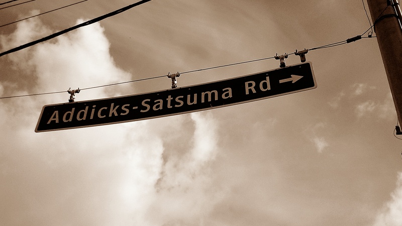
(Above photo: Street sign at the corner of SH-6 and Addicks-Satsuma Rd., where the only surviving portion of the road remains independent of Highway 6)
Back in the 1960's, the re-establishment of State Highway 6 (SH-6) through the Bear Creek & Addicks area overlayed most of what was originally Addicks-Satsuma Rd. The original two-lane road ran north from US-90 in Addicks up to a northern terminus at FM 529, with a few bends and hooks along the way. When the highway was re-established, it consumed most of Addicks-Satsuma Road, but left behind a few traces of the original right-of-way that were not part of the new and improved plan. The biggest one is actually still in use today under the name Addicks-Satsuma Rd. Though today it is little more than a back street that parallels SH-6, this road is actually part of the original alignment of Addicks-Satsuma Rd. It was decided that the new highway would run a more direct path between US-90 and Hempstead Rd., diverting from the original alignment, and cutting a path through the prairie towards what would eventually become US 290. The rest of Addicks-Satsuma Rd. was left behind as a secondary street. The point where the above photo was taken is where Addicks-Satsuma and SH-6 parted ways.
From there, it makes a series of 90 degree turns, and the familiar winding turn where it resumes its path north towards FM 529. The road was never widened, and there are still lots of tall, knotty trees lining the road that help proclaim the age of the road in comparison with the relatively young trees that line Highway 6.
Another trace of the old alignment can be found further south at the intersection of Patterson Rd., beside the Addicks-Bear Creek Cemetery. The slab of pavement where people park their cars to go walking is actually a chunk of the old Addicks-Satsuma road alignment that was left behind when the new highway skirted right past it. Originally, this cemetery had no real parking lot. Most likely, cars would just parallel park on the side of the road when visiting the cemetery. It wasn't until this slab of the old road was left behind that it became a good idea to utilize it as parking. And of course, the third major trace of the old road is the abandoned South Mayde Creek bridge segments in the reservoir, but they have a chapter of their own...
SOME PHOTOS TAKEN ALONG ADDICKS-SATSUMA IN 2011 (The active but bypassed segment)
ASR 001.jpg : The big curve near the bayou
ASR 002.jpg : The big curve near the bayou
ASR 003.jpg : Facing north from the big curve towards West Little York.
ASR 004.jpg : Facing north at the West Little York intersection.
ASR 005.jpg : A single residence that survived after construction of Truitt Middle School just behind it. The home was finally acquired and demolished in 2014.
ASR 006.jpg : Facing north along Addicks-Satsuma running through Hearthstone Place.
ASR 007.jpg : The terminus of Addicks-Satsuma Rd. at FM 529, facing north.
PHOTOS OF THE SLAB AT PATTERSON RD. IN 2011
PR 001.jpg : The present day parking lot for the Addicks Bear Creek Cemetery, closely bordered by the newer SH-6 to the left.
PR 002.jpg : Facing south across Patterson, you can see a wider grass shoulder where the road once ran.
___________________________________________________________________________________________________________________________________________________________________________________________________________________________
ADDICKS-SATSUMA RD. (SOUTH MAYDE CREEK BRIDGE)
(Above photo: The view of the abandoned southern bridge as it looks from present day SH-6 in Addicks Reservoir (2012)
Two of the lesser-known historic jewels in West Houston are the South Mayde Creek Bridges, which sit hidden along the western side of State Highway 6 in the Addicks Reservoir near IH-10. The bridges were originally part of Addicks-Satsuma Rd. before it was overtaken by SH-6 in the mid 1960's.
Early road maps of Harris County show a slight curve in the original road as it passes over South Mayde Creek just north of the Addicks Dam on the way towards Patterson Rd., but this curve was eliminated from the configuration during the 1960's when SH-6 was built approximately 8-10 feet above ground level through the reservoir. The elevated length of SH-6 would ensure that water retention from the reservoir would not flood the roadway in even the heaviest of rainfall.
The South Mayde Creek Bridges, which were constructed around 1959, would be left behind after the SH-6 takeover, and are currently the only surviving portions of the original right-of-way for Addicks-Satsuma Rd. today. The bridges are typical mid-century construction, made of concrete and steel with solid wood legs and crossbeams supporting the structure. Aside from some missing guardrail beams and rust, the south bridge looks to be fairly intact, and could hold its own under the demands of moderate traffic. North of the bridge, the road surface is gone, but some scattered hunks of asphalt and pieces of dislodged concrete conduit are still strewn along the old right-of-way. In addition to these ruins, there is also a variety of old trash littering the area, including peel-tab beer cans, and old bias ply tires. To give you an idea of the age of this litter, bias ply tires have not been standard on cars since the late 70's. Since then, all passenger cars have worn radial ply. Chances are these tires have been here since the early 1980's. North of the creek is the second section of bridge, which is identical in design to the south bridge, but almost completely buried by the topsoil. It's still visible, but you really have to be on foot to see it properly from the roadside.
The following photos were taken by me in January through May of 2012. The bridge is difficult to access during the summer months or following periods of heavy rainfall, but in the winter months that follow a summer drought, the area becomes very ideal for exploration.
THE SOUTH BRIDGE.
ASB 001.jpg : The view of the south bridge as it appears looking over the elevated SH-6 guardrail
ASB 002.jpg : Facing south along SH-6 from the south bridge location, to give viewers an idea of its location.
ASB 003.jpg : A small pond in the reservoir near the site of the two bridges.
ASB 004.jpg : One of two gates on either end of the bridges that would be closed during heavy rainfall and flooding.
ASB 005.jpg : Facing the elevated wall of SH-6 from the south flood gate location
ASB 006.jpg : Coming up on the south bridge from ground level (the original elevation of Addicks-Satsuma Rd.)
ASB 007.jpg : The surface of the south bridge.
ASB 008.jpg : The surface of the south bridge.
ASB 009.jpg : The surface of the south bridge.
ASB 010.jpg : The rarely-seen underside of the south bridge, made of wooden supports.
ASB 011.jpg : Another view underneath the south bridge.
ASB 012.jpg : Some of the discarded trash and debris seen around the old bridge site.
ASB 013.jpg : More old debris.
ASB 014.jpg : A pair of old drainage outlets that were likely part of the original Addicks-Satsuma Rd. prior to elevating SH-6.
ASB 015.jpg : An old tree near the south bridge entangled with old vines.
ASB 016.jpg : Another old tree near the bridge that grew around a very old section of barbed-wire fencing.
ASB 017.jpg : The surface of the south bridge.
ASB 018.jpg : An old tree that has begun to grow around the bridge's steel rails.
May 2012a 002.jpg : The surface of the south bridge.
May 2012a 003.jpg : The surface of the south bridge.
May 2012a 004.jpg : The surface of the south bridge.
May 2012a 012.jpg : A view of the south bridge in relation to SH-6, facing south.
May 2012a 013.jpg : The south flood gate for the bridge.
May 2012a 014.jpg : Black & white photo of south bridge.
May 2012a 015.jpg : Black & white photo of south bridge.
May 2012a 016.jpg : Black & white photo of south bridge.
May 2012a 020.jpg : The south flood gate for the bridge (using a vintage filter effect).
THE NORTH BRIDGE.
May 2012a 005.jpg : The north bridge as it appears from elevated SH-6, facing north.
May 2012a 006.jpg : The north bridge surface.
May 2012a 007.jpg : The north bridge surface.
May 2012a 008.jpg : The north bridge surface.
May 2012a 009.jpg : How the north bridge appears from elevated SH-6 (facing south).
May 2012a 010.jpg : How the north bridge appears from elevated SH-6 (facing south).
________________________________________________________________________________________________________________________________________________
ALDINE-WESTFIELD RD.
(Above image: Google Earth aerial image of the realignment site of Aldine-Westfield Rd. from 3/10/2011)
Aldine-Westfield Rd. in the Spring area was realigned during the 1970's between Cypresswood and Hirschfield Rd. The original alignment of the road, which was among some of the oldest in the area, had a pretty nasty dead-man's curve. It wasn't the sudden 90 degree turn in direction like most roads in the area, but a "beveled" curve that got tighter as it progressed.
Many speeding muscle cars lost their traction hooking a high speed turn around this section of road, and wound up careening into the ditch. After the realignment, the new section of road moved much more smoothly over the land, making it far less dangerous to traffic. The old corner of road remained open to serve several neighborhood entrances already in place, taking the name Old Aldine-Westfield, to specify that it had once been a part of the road.
While Aldine-Westfield's current corridor is now four lanes of divided concrete, the old section of road remains two-lane asphalt, as it used to be, but is maintained and repaved when necessary, and not allowed to deteriorate.
AWR 001.jpg : Google Earth image of the original configuration of the realigned portion of Aldine-Westfield, 1944
AWR 002.jpg : Google Earth image of the same location after the realignment, shown here in 1989.
AWR 004.jpg : Approaching the split between new & old alignments, coming south from Cypresswood Dr., Dec. 2011.
AWR 005.jpg : Following Old Aldine-Westfield Rd. along the original curve, Dec. 2011.
AWR 006.jpg : Following Old Aldine-Westfield Rd. along the original curve, Dec. 2011.
AWR 007.jpg : Where the old road intersects the new road. This was the location of the sharpest point in the original turn.
________________________________________________________________________________________________________________________________________________
ALIEF-CLODINE RD.
Alief-Clodine Rd., which runs parallel to the Westpark Tollway, has some interesting realignment history. It existed in Harris County as far back as the turn of the 20th century. Everything west of Clodine is known as Front St., which comes to a dead end in Fulshear, TX, and everything east of the historic part of Alief is either Harwin or Westpark Drive (we're talking pre-tollway). Just east of Alief, the road was split in two directions during the mid 20th century. The southern fork was named Harwin, and the original Alief-Clodine corridor was overtaken by Westpark Drive, which in turn was later taken over by the Westpark Tollway in the early 2000's.
Just east of Wilcrest Dr., very close to the Abundant Life Cathedral and directly off the shoulder of the Westpark Toll Road near a toll tag reader, sits a section of abandoned railroad bridge left behind after the tollway was completed. The railroad corridor gave way to the toll road, and was removed completely from its original alignment. This bridge is a surviving remnant of this railroad alignment. I originally thought it to be part of the old Alief-Clodine alignment, but the lack of adequate side barriers indicates that it was probably a railroad bridge that ran parallel to Westpark.
Coordinates for locating the bridge segment: 29 degrees 43'02.61" N, 95 degrees 33'58.01" W.
Sep 2014a 002.jpg : The abandoned railroad bridge.
Sep 2014a 003.jpg : Another view of the bridge, facing east along the Westpark Tollway.
_________________________________________________________________________________________________________________________________________________
BAMMEL-NORTH HOUSTON RD.
(Above photo: Facing south along the old alignment of Bammel-N. Houston towards 249. This was once the main road before 1978)
In the late 1970's, the Northwest Park neighborhood was built near the intersection of Bammel-North Houston Rd. and FM 149 (known as SH-249 today). This neighborhood is located just inside the circumference of Beltway 8 today, but at the time, Bammel-North Houston was a long, straight two lane road out into the prairie, headed for Bammel, which is near FM 1960.
With the implementation of the new neighborhood, the southern tip of Bammel-North Houston was realigned in a swooping curve to the east, providing an updated entrance road for the new community, and making a direct intersection with neighboring North Houston-Rosslyn Rd. Originally, the two roads intersected FM 149 several blocks apart.
The original alignment of Bammel-North Houston was left open to serve nearby commercial interests, and renamed Old Bammel-North Houston Rd. The truncated northern end of the old alignment was turned into a cul-de-sac, and remains so today. It is not the most exciting realignment, but it is one that I came upon purely by accident, after I got good at spotting realigned roads.
BNH 001.jpg : Google Earth image of Bammel-North Houston Rd. and FM 149 as they appeared in 1944.
BNH 002.jpg : Google Earth image of the same location in 1978, after the Northwest Park community was built.
BNH 004.jpg : Standing at the north end of the old alignment (cul-de-sac) facing north towards Beltway 8, Dec. 2011.
BNH 009.jpg : Sign labeled "Old Bammel-North Houston Rd." hanging above the old alignment, Dec. 2011.
_______________________________________________________________________________________________________________________________________________
BARKER-CYPRESS RD.
Barker-Cypress Rd. was realigned during the late 70's early 80's from its original configuration. Today, it makes a fairly straight north/south path from I-10 all the way up to 290. Originally, it was a zig-zag path through the Katy prairie that now wears several names. Parts of Saums, Greenhouse, Old Greenhouse, and Gummert Rd. all make up parts of the original Barker-Cypress.
The realignment connected the gap between Saums Rd. and present day Kieth-Harrow Blvd. Kieth Harrow originally was known as Gertie Rice Farm Rd. until around 1980. I am not sure of the origins of the names Kieth & Harrow at this time. To follow the original path of Barker Cypress Rd. using modern street names, here is the way you would have to drive:
1.)North on Barker-Cypress to Saums Rd. (@ Cullen Park). Turn left on Saums. Mar 2016a 008.JPG
2.)West on Saums Rd. to Greenhouse Rd. Turn right on Greenhouse. Mar 2016a 011.JPG
3.)North on Greenhouse to Clay Rd. (Originally an offset intersection, you once had to turn right on Clay, and immediate left back on Greenhouse). Mar 2016a 013.JPG
4.)North on Greenhouse to Old Greenhouse Rd. Turn right on Old Greenhouse Rd.
5.)East on Old Greenhouse Rd. Mar 2016a 019.JPG
6.)Old Greenhouse turns left now heading north on Old Greenhouse Rd., passing Kieth Harrow Blvd (Gertie Rice Farm Rd.) Mar 2016a 021.JPG
7.)Road ends at Gummert Rd. Turn right on Gummert. Mar 2016a 023.JPG
8.)East on Gummert Rd. to Barker-Cypress Rd. Turn left on Barker-Cypress Rd. (meeting present day alignment).
What a hassle!!! I can see why they built the bypass and straightened out Barker-Cypress. I am planning on adding some photos to this chapter soon if I can get some good lighting.
________________________________________________________________________________________________________________________________________________________________________________________________________________________
BARKER-CLODINE RD.
(Above photo: Facing north along Barker-Clodine from the old Beeler Rd. intersection, 2011)
The text for this chapter has been temporarily suspended. New information has required a revision of the facts and lore surrounding this road.
BCR 004.jpg : A section of Barker-Clodine near IH-10 that is still paved and used by automobiles. This is facing north, while the bicycle/jogging trail begins facing the other direction.
BCR 006.jpg : The entrance to the LH7 Ranch, along Barker-Clodine just a few blocks from IH-10.
BCR 002.jpg : The north gate to the Barker-Clodine Trail.
BCR 003.jpg : The partial pavement, partial gravel surface of the Barker-Clodine trail that runs between the north and south gates.
BCR 013.jpg : The S-curve in the road where the old Beeler Rd. intersection is. The south gate is to the left of this photo near a small parking lot.
_________________________________________________________________________________________________________________________________________________
BAUER RD.
(Above photo: The original south end of Bauer Rd. facing south towards 290, Jan 2012.)
Album 20 Pic 33.jpg : The split between new and old Bauer Rd. alignments near 290, Jan. 2012.
Album 20 Pic 34.jpg : Facing south along the original alignment of Bauer, bypassed in the 1990's, Jan. 2012.
Album 20 Pic 35.jpg : At the old intersection of Bauer with 290, facing east towards the newer intersection, Jan. 2012.
__________________________________________________________________________________________________________________________________________________
BOUDREAUX RD.
(Above photo: The split where the new Boudreaux alignment on the east side of 249 curves south of the original alignment, Apr. 2014)
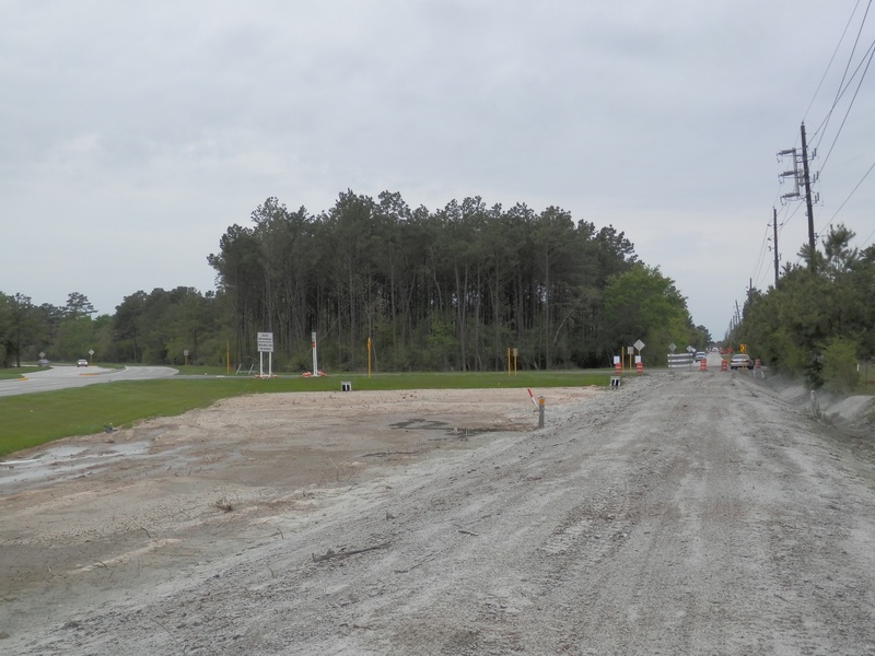
Boudreaux Rd. in north Harris County travels through the back woods of the Cypress and Tomball areas, and has had two major realignments in its past. Around 2001, the intersection with Kuykendahl Rd. was repositioned slightly south to intersect smoothly with Spring-Stuebner Rd. The remnant road segment remained vacant until the last 2000's when construction crews used it as an access road to construct a new property nearby. The segment still exists as of early 2014, but the planned Grand Parkway segment F2 may change that.
Photos from 2011:
BOUD 003.jpg : Looking east showing both the old & new alignments of Boudreaux Rd.
BOUD 004.jpg : Looking west along the original Boudreaux right-of-way.
BOUD 005.jpg : Looking directly east along the old alignment, which is currently blocked off except for the construction vehicles.
Another realignment was done in early 2014 on Boudreaux Rd., west of SH-249. The new intersection with 249 was moved to the south to accommodate the Grand Parkway F2 segment, which was under construction by late 2013. It just so happened that there was an unfinished intersection along 249 near Parkway Chevrolet which became the new alignment of Boudreaux. The original bypassed segment is still a vital access road for a nearby community, so the road will likely not be abandoned, but be rebadged as "Old Boudreaux Rd."
Photos from February 2013:
Feb 2013a 086.jpg : SH-249 frontage road at future Boudreaux intersection (here just a dead end)
Feb 2013a 087.jpg : SH-249 frontage road at future Boudreaux intersection, Graceview Baptist Church sign in photo
Feb 2013a 088.jpg : SH-249 at future Boudreaux intersection, facing south with Parkway Chevrolet in view
Feb 2013a 089.jpg : SH-249 at future Boudreaux intersection, facing west across 249 into the trees
Feb 2013a 090.jpg : SH-249 at future Boudreaux intersection, facing east along path of realignment (to be)
Feb 2013a 091.jpg : Graceview Baptist Church at SH-249 and future Boudreaux intersection
Feb 2013a 094.jpg : Original Boudreaux intersection with SH-249, to the north of the new intersection, facing west.
Feb 2013a 095.jpg : Original Boudreaux intersection with SH-249, facing west.
Feb 2013a 096.jpg : Original Boudreaux intersection with SH-249, facing northwest across 249.
Photos from January 2014:
Jan 2014a 074.JPG : New alignment of Boudreaux pushing through from SH-249 to merge with the original road.
Jan 2014a 075.JPG : Facing southwest along new alignment of Boudreaux as it cuts through from SH-249
Jan 2014a 078.JPG : The sharp turn on Boudreaux where the realignment to SH-249 will begin.
Jan 2014a 145.jpg : The original Boudreaux intersection with SH-249, southwest corner, just cows grazing in a field.
Jan 2014a 147.jpg : Traveling southbound on the portion of Boudreaux that will be bypassed in the realignment near SH-249.
Jan 2014a 150.JPG : Facing south on the old part of Boudreaux that Grand Parkway will pass over.
Jan 2014a 151.JPG : Facing east across Boudreaux Rd. towards SH-249 where flyover supports can be seen in the distance.
Jan 2014a 152.JPG : Facing north along bypassed Boudreaux segment from the spot Grand Parkway will pass over.
Jan 2014a 153.JPG : Zooming in across the trees from Boudreaux Rd. towards the new Grand Parkway support columns at SH-249.
Jan 2014a 154.JPG : The wooden sticks with orange tape mark the boundaries of the Grand Parkway right-of-way where it will pass over Boudreaux Rd.
Jan 2014a 156.JPG : The corner of the original Boudreaux Rd. that was bypassed (same as photo 078 but several days later)
Jan 2014a 157.JPG : Facing east along the unfinished realignment of Boudreaux that will extend to SH-249.
Apr 2014a 024.JPG : Facing east on Boudreaux where the new and old alignments merge, and the old road will be dead-ended.
Apr 2014a 025.JPG : Facing east on Boudreaux at a nursery that just gained a few extra yards of driveway space.
Apr 2014a 026.JPG : Facing west on Boudreaux at the split between the new and old alignments.
Apr 2014a 027.JPG : Facing west on Boudreaux from the original alignment, now covered up. Soon it will grow over with grass.
Apr 2014a 028.JPG : Focused on the tie-in that was built to connect the old alignment with the new one, so it can still be used to serve some businesses and homes that were already in place.
Apr 2014a 029.JPG : The point where old Boudreaux ends, and blends into the newer tie-in. Similar to what happened with Louetta.
Apr 2014a 030.JPG : Standing on the old Boudreaux alignment facing east towards the merge of the new and old roads.
Apr 2014a 031.JPG : The newer intersection with SH-249 now partially open to traffic, facing west across SH-249. Compare this photo with those taken in February 2013 when this intersection was just two dead ends, and Boudreaux was still a few blocks to the north of here.
Photos from December 2015:
Dec 2015a 012.JPG : The original Boudreaux/SH-249 intersection, now severed by the completed Tomball Tollway. (Facing west across 249).
Dec 2015a 013.JPG : The original Boudreaux/SH-249 intersection. Across the freeway is the rest of Old Boudreaux, now renamed Rocky Rd.
_________________________________________________________________________________________________________________________________________________
CAMERON RD.
(Above photo: Facing south on what used to be Cameron Rd., now confined within the perimeter fence of the forgery, 2011)
Around 1980, Telge Rd. was extended south of 290 to West Rd., and Cameron Rd. was closed off, in favor of a new factory entrance off Telge Rd. The perimeter fence was built over the old road, and piece by piece, Cameron's intersection with 290 was slowly erased from the map. Today, there is a big pond and fenced off area, and a fairly young cross street (visible in the above photo) that cut right through the old road alignment at some point.
The road never ran all the way to West Rd., because West Rd. didn't exist when it was first built in the 1960's. It came to a dead end after you passed all the buildings.
Without being granted access to Cameron Rd., these are the only pictures I was able to get of the old street, in 2011.
CAM 001.jpg : Cameron Rd. as it looks from a side street that bisects the old right-of-way near the railroad crossing.
CAM 002.jpg : Facing directly south along Cameron Rd. from the chain link fence that encircles the whole forgery.
CAM 003.jpg : Facing north towards US 290 along the right-of-way. Notice the alignment of the power poles.
CAM 004.jpg : Looking south at Cameron Rd. from across the street. There is a small portion of old pavement visible near the curb.
___________________________________________________________________________________________________________________________________________________
CLAY RD.
(Above photo: The realignment site near Eldridge Parkway, 2012. This is along the side of present day Clay Rd. where a portion of the old road surface is jutting out of the fenceline into the clearing. The new road cut through part of the old alignment, creating these stumps of asphalt on both sides of the road.)
Clay Rd., which runs east/west across the entire western half of Harris County, has been on maps dating back to the turn of the 20th century. It begins at Hempstead Highway near the town of Fairbanks, and runs west all the way into the eastern edge of Waller County, terminating at Schlipf Rd. Since the 1960's, the road has undergone several modifications to become the major arterial street that it is today.
The road has been widened from two lanes to four starting at Peek Rd. in Katy, all the way to Hempstead Rd. Everything east of SH-6 has been repaved with concrete, instead of the original asphalt surface. Clay Rd. has also been realigned in two places. The first location worth mentioning is at the intersection of SH-6, formerly known as Addicks-Satsuma. Prior to the 1970's, Clay Rd. had a huge offset at SH-6. The original intersection at Addicks-Satsuma was several blocks to the south of the present-day intersection. Today, this older street is named Pine Forest Drive, after the Pine Forest Country Club, and has a Raceway filling station at the corner. When Clay Road was realigned, they built a huge swooping curve to the north to meet up with the other half of Clay, and this is our present intersection. You may recognize the swooping curve as the home of the Precinct 3 Courthouse Annex, and the Katherine Tyra Public Library.
CLAY 003.jpg : Intersection of Clay Rd. and Pine Forest Drive (original path for Clay Rd.), facing east, 2011.
CLAY 005.jpg : Eastbound along Pine Forest Drive towards SH-6, 2011.
CLAY 006.jpg : Eastbound along Pine Forest Drive towards SH-6, 2011. This is an old farm house that pre-dated the realignment of the road.
As you venture eastward along Clay from SH-6, you pass by the northern boundary of Bear Creek Pioneer's Park. This is the location of another realignment, which was done during the late 1970's to bypass a wickedly sharp corner near Addicks-Fairbanks Rd. (Eldridge Parkway). This realignment left behind an abandoned road segment which is largely unknown, except to those who lived in the area at the time.
To find this abandoned road, you must begin at War Memorial Drive, which runs through the park. To the east of this street is a series of soccer fields, and then a sharp wall of trees. The wall of trees marks the location where Clay Rd. turned 90 degrees to the south, and then made another 90 degree turn to the east. This portion of road was often flooded during heavy rains, and difficult to navigate at night. As a result, TxDOT straightened this portion of Clay Rd., and gave it a gradual curve to the south where it met up smoothly with the next portion of Clay Rd. at Addicks-Fairbanks Rd.
CLAY 001.jpg : Google Earth image showing Clay Rd. and Addicks-Fairbanks (Eldridge) intersection, facing west in 1943.
CLAY 002.jpg : Google Earth image showing the same intersection in 2010, with the new alignment of Clay Rd. cutting through the old one.
The abandoned road has not been maintained at all, and has become completely overgrown; so much that even the asphalt road surface is barely detectable under decades of fallen leaves, as well as the accumulation of grass and mud. I ventured into the foliage during the winter months of 2011 when the greenery had receded, and found the southbound alignment, which was buried by about an inch of mud and leaves. The asphalt was badly deteriorated, and could be crushed with the heel of a hiking shoe. The tree branches had grown too thick to walk along the entire old alignment, but it was obvious that something had once cut through there.
CLAY 009.jpg : The abandoned right-of-way for Clay Rd. just inside the tree line east of Bear Creek Pioneers Park.
CLAY 008.jpg : Closer look at the deteriorated asphalt road buried beneath the mud and leaves.
The road then turns 90 degrees to the east, and eventually crosses paths with the newer alignment of Clay Rd. just a block or so from the intersection of Eldridge Parkway. Unless you know where to look, it is difficult to notice the clearing in the trees where the abandoned road spills out into the open, but if you follow the barbed wire fence, you will notice a large slab of old asphalt road jutting out from the fence line, which is about 12-14 inches higher than the grassy shoulder of the new alignment.
CLAY 010a.JPG : A view of the southern shoulder of the newer Clay Rd. alignment where the old right-of-way meets up with it. The white lines in the photo indicate the location of the clearing in the trees.
CLAY 011.jpg : A closer look into the tree line, looking west along the old Clay Rd. alignment. The road surface has been overgrown by grass.
CLAY 012.jpg : The old asphalt slab of road that pokes out from the fence line along the new alignment.
CLAY 013.jpg : A small portion of the old right-of-way is still visible on the northwest corner of Clay & Eldridge. This was the original intersection before the realignment put the crossing a few yards south of here. You can still see vehicles passing along Eldridge through the clearing in the foliage.
_____________________________________________________________________________________________________________________________________________
CUTTEN RD.
(Above photo: Standing on the old alignment of Cutten where it dead ends just north of Beltway 8 & SH 249, Jan. 2012)
When the Sam Houston Tollway was constructed during the late 1980's, the southern end of Cutten Rd. received a realignment. Before all the construction, Cutten Rd. ran directly south where it intersected FM 149. In the above photo, you can see the intersection of the tollway and SH 249 (formerly 149) from the dead end of the old Cutten alignment. The new alignment took a turn to the west where it intersected SH 249 just north of the tollway. The remaining section of road was a dead end, as the above photo shows. At some point, the Shell station went up, and they poured cement all the way to this dead end, so it could be accessed via Cutten Rd. You can see the different toned pavement on the left versus the asphalt paved Cutten Rd.
CUT 005.jpg : A link to the same photo above
CUT 006.jpg : Facing south at the split between the new alignment (right) and the original alignment (left), Jan. 2012.
CUT 007.jpg : Standing at the south end of the old alignment facing north, Jan. 2012.
In late 2012, Cutten Rd. was altered yet again. The new extension of West Greens Rd. from Hollister to Cutten would reshape the intersection. This site was just a few blocks north of this old realignment from the 80's. Now, traffic on Cutten must turn to stay on Cutten, or the road will just continue on to Hollister Rd.
_______________________________________________________________________________________________________________________________________________
CYPRESS-NORTH HOUSTON RD.
(Above photo: Cypress-North Houston Rd. new and old alignments near Timberlake Estates, 2011.)
Cypress-North Houston Road (or CNH for short), is among the oldest when it comes to road running through western Harris County. It dates back to the age of oyster shell paving, when there was nothing on either side of the road but tall trees and the occasional mailbox. It originally started at Hempstead Rd. and ran all the way east to Jones Rd, making a couple of zig zags along the way. The biggest one was just a few blocks from the terminus at Jones Rd., where CNH made a 90 degree turn to the north, and a block later, another 90 degree turn to the east where it finally intersected Jones Rd.
This was obviously done in observation of private property lines when the road was first built, but in the later 1960's, TxDOT bypassed the sharp turns at the eastern end of the road, and cut a path straight through to Jones, where the present day intersection is. The older bypassed portion of CNH was renamed McCracken, after the family that owned property inside the corner of the road bend. It remains open to traffic today, but few probably stop to think about it being the original Cypress-North Houston right of way.
In 1982 (a seemingly great year for TxDOT's budget), Cypress-North Houston was expanded to four lanes, and realigned at three locations to smooth out the sharp corners. The first realignment was done at Telge Rd. to fix an offset. There is little evidence today of this realignment, but the power line path shows the original right of way.
The second realignment was done right in front of Timberlake Estates, one of the older suburbs in the area. It sits on the north side of CNH behind Galson Auto & Body. If you've ever noticed the little branch-off road at that curve, it's actually a remnant section of the original Cypress-North Houston Rd. that was left behind after the realignment. The little road is still only two lanes wide, paved with asphalt, and has trees on both sides. The sharp corner caused lots of accidents, especially during the night. The "island" (the section of land between the old and new roads) also contains some of the best evidence of the realignment. There is a section of chain link fence, and the original brick entrance marker to Timberlake Estates. Basically, the original neighborhood entrance is across the street from the actual neighborhood.
Immediately to the east of this realignment, you will notice a few small houses. These homes were present before the realignment, and lost a substantial amount of street front property during the process. The western-most house had to be torn down, but the others stayed put, although dangerously close to a busy street.
The third realignment was done just a few blocks east at E. Shadow Lake Dr., an entrance to the Cypress Creek Estates community. This is the realignment at which you can find evidence of the original oyster shell paving. The sharp turn was simply smoothed out, with no remnant road left behind, however, the shoulders of E. Shadow Lake Ln. tell the tale of the procedure. Today, there remains a pair of original sewer drain pipes that wouldn't have ordinarily been in place unless a road had once ran there. On the road itself, two "ears" of asphalt stick out further than the actual road, and these ears are part of the old Cypress-North Houston alignment. It just happened that the asphalt was chiseled away, revealing some of the old oyster shell paving beneath, and this tiny piece of history managed to survive the TxDOT cleanup. The photos below will show all four of the points in which Cypress-North Houston was realigned.
The realignment site at Telge:
CNH 019.jpg : The northwest corner of Telge & CNH, showing where the original alignment continued straight ahead (2011).
CNH 020.jpg : Close-up shot of the asphalt pavement on CNH where the old alignment once veered from the present course (2011).
The realignment site across from Timberlake Estates near Mile Dr.:
May 2014a 003.jpg: Google Earth aerial view of the road as it looked in the 1940's before the realignment.
May 2014a 004.jpg : Google Earth aerial view of the road after the realignment (2013 current)
Apr 2014a 069.JPG : Facing the split from the west, where the newly expanded road veered from the original. (April 2014)
CNH 022.jpg : Inside the old corner of CNH looking east, 2011. This is about what the rest of the road looked like at one time.
CNH 007.jpg : Facing west along CNH from inside the old alignment, 2011.
CNH 013.jpg : Facing west at what used to be the original entrance road to Timberlake Estates, 2011.
Apr 2014a 071.JPG : Facing the split from the east (April 2014).
Apr 2014a 072.JPG : Inside the old corner of CNH looking east (April 2014).
CNH 023.jpg : The dead end of old CNH where the new road took over the original alignment, facing east in 2011.
Apr 2014a 074.JPG : The dead end of old CNH, facing east (April 2014).
Apr 2014a 075.JPG : Facing north into Timberlake Estates from the original entrance site. Ahead is Tall Forest Drive. (April 2014).
CNH 027.jpg : Some of the houses on the north side of CNH that were disrupted by the realignment.
Apr 2014a 078.JPG : The old brick entrance marker hidden in the vines and trees (April 2014).
The realignment site near Eldridge, in front of E. Shadow Lake Dr.:
CNH 030.jpg : Facing east along the original CNH alignment from E. Shadow Lake Dr. , 2011.
CNH 028.jpg : Facing west along the original CNH alignment from E. Shadow Lake Dr., 2011.
Apr 2014a 060.JPG : Facing east along the original CNH alignment from E. Shadow Lake Dr. (April 2014).
Apr 2014a 062.JPG : Leftover signs of the old CNH road where it originally intersected E. Shadow Lake Dr. (April 2014)
Apr 2014a 065.JPG : The leftover road surface on the other side (April 2014).
Apr 2014a 066.JPG : Close up of the edge where some of the original oyster-shell pavement can be seen. (April 2014).
Apr 2014a 067.JPG : One of the old drainage pipes that ran underneath CNH before the realignment (April 2014).
Apr 2014a 068.JPG : The drain pipe on the other side of E. Shadow Lake Dr. (April 2014).
The realignment site near Jones Rd. (now named McCracken):
Apr 2014a 053.JPG : Facing east on old CNH towards the original intersection with Jones Rd. prior to the 1970's (April 2014).
Apr 2014a 058.JPG : Facing south along old CNH from the corner in the road towards the present CNH alignment (April 2014).
Apr 2014a 056.JPG : The overgrown fence surrounding the property once owned by the McCracken family. I was told that at one time the family had a farm and petting zoo on the property. Today it is all closed off and clearly marked with no trespassing signs.
Apr 2014a 059.JPG : A closer look at the fenced off property inside the corner of the old CNH alignment, (April 2014).
CNH 015.jpg : A photo of the corner of the road, traveling from west to south, 2011.
_________________________________________________________________________________________________________________________________________________
CYPRESS-ROSEHILL RD.
(Above photo: Surviving segment of the old Cypress-Rosehill Rd. near Hempstead & Fry Rd., Apr. 2014)
Cypress-Rosehill Rd. originally began at Hempstead Rd. right in the heart of Cypress, and ran north to the small settlement of Rosehill. The route formed in the later 1800's and later, when cars and trucks replaced the horse, became a two-lane paved blacktop running between the two towns. In 2005, TxDOT extended Fry Rd, which at the time, came to a dead end just a few blocks north of FM 529 after Cy-Springs high school. The extension ran all the way north up to US 290, and would align with Cypress-Rosehill Rd. Everything north of 290 would remain as Cypress-Rosehill, everything south would be Fry. But Fry Rd. didn't align perfectly with the original intersection at Hempstead Rd.
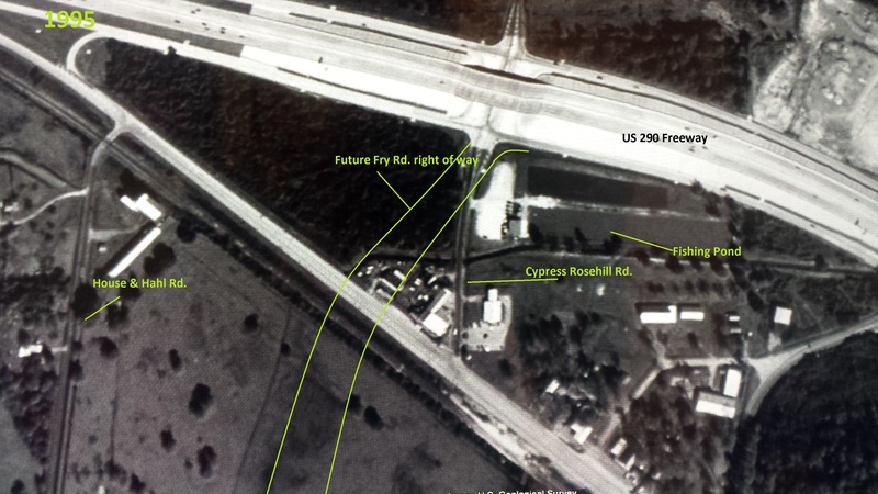
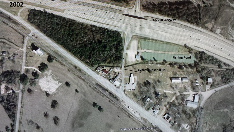
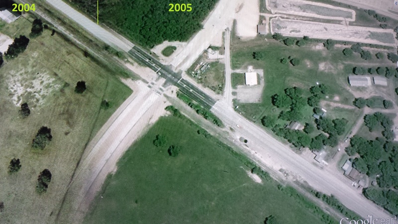
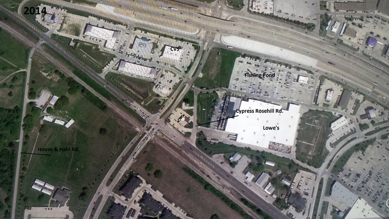
TxDOT built Fry Rd. a block to the west of the original Cypress-Rosehill starting point, and weaved the road into place, cutting off the southern tip of Cypress-Rosehill. The remnant stub between Cypresstop Historical Park and the auto repair shop is all that remains of the original Cypress-Rosehill Rd. Motorists still use it as a back alley drive, but the road is no longer necessary.
Apr 2014a 094.JPG : The starting point of Cypress-Rosehill at Hempstead Rd. (April 2014)
Apr 2014a 095.JPG : Facing east on Hempstead Rd. from Cypress-Rosehill's original intersection (April 2014).
Apr 2014a 096.JPG : Facing north along the old road with Fry Rd. cutting through just ahead (April 2014).
Apr 2014a 097.JPG : A little section of railing for a creek below. This standard postwar railing design is typical of older roads in Harris County, and in this case, is a bit of evidence as to the age of this particular road segment (April 2014).
Some Google Earth images showing the original configuration.
Top left-1995, Top right-2002, Bottom left-A blend of 2004 & 2005, and Bottom Right-2014.
________________________________________________________________________________________________________________________________________________
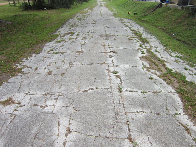
DAIRY-ASHFORD RD.
(Above photo: Facing north on the old segment of Dairy-Ashford on the east side of Tulley Stadium, which was renamed Tulley Dr., 2012)
Dairy-Ashford Rd., which runs north/south between I-10 and US-59 in the urban sprawl of West Houston, was realigned near I-10 many decades ago. Today, the road makes a direct connection with I-10 on the west side of Tulley Stadium, but originally, the right of way for Dairy-Ashford took a 90 degree right turn just before the stadium, and another 90 degree left turn where it resumed north towards I-10. Of course, at the time this original configuration was designed, there was no Tulley Stadium, and I-10 was just a two lane blacktop known as Katy Rd. The stadium would be constructed in the small nook made by the winding road during the 1960's, and Dairy-Ashford would be realigned on the west side of the stadium.
Around a decade after this realignment, Dairy-Ashford was extended north of I-10, cutting through a corner of land that was once home to a small airfield. I am not certain of the name of this airfield, but early road maps of Harris County form the 1950's-1960's label the field as Crutcher-Rolfs-Cummings. It may have been a privately owned airstrip. In any case, Dairy-Ashford cut through this piece of land and hooked to the west to intersect Eldridge Parkway/Addicks-Fairbanks Rd.
Though most Houstonians are well aware of the name Dairy-Ashford, few actually know where the road gets its name from. The name Dairy is referring to Alief, which was originally called Dairy before the town applied for a Post Office. Due to there already being a town under the name Dairy, the town was renamed Alief, after the postmaster's daughter. Ashford refers to the now vanished town site of Satsuma, near Eldridge Parkway and US 290. Back in the old days, the town of Satsuma was also known to the railroad community as the Ashford/Thompson Switch. Because the road "Dairy-Ashford" began in Alief and was a key part of the route to Satsuma/Ashford, the name Dairy-Ashford was given, similar to the style in which Barker-Cypress, Cypress-North Houston, and North Houston-Rosslyn were named. Had the road been built at a different time, it might have been named Alief-Satsuma Rd.
(Three different Google Earth images depicting the area near I-10 and Dairy-Ashford Rd., from 1944, 1973, then 2011.)
______________________________________________________________________________________________________________________________________________
DUNCAN RD.
(Above photo: Facing south on the original Duncan Rd. from FM 1960, Dec. 2012)
Duncan was a narrow, two-lane, asphalt paved road that started at FM 1960 in the Champions Forest area, and ran south/southeast through the trees where it came to a dead end at what is now the northern end of Champions Crossing (a recently constructed suburb). It was named after a local resident whose descendants were none too happy about the road carrying their namesake being taken over and erased from history.
I was working in the area at the time of the expansion, and watched them slowly attempt to widen the narrow corridor to contain a four lane thoroughfare. Because of the age of Duncan Rd., many establishments and property fencing, etc. had already been built close to the roadside. Lots of driveways were shrunk, and over the course of several months, all the nearby utilities and poles were relocated. They expanded the road slowly until it finally connected with the upcoming extension of Hollister, and was eventually opened to traffic in early 2013. Though the Duncan Rd. street signs were removed, the family was given the consolation prize of a street sign along Hollister that paid honorable mention to Duncan Rd.
I got a few pictures of the road before it was expanded to four lanes, though some construction efforts can be seen in the photos, taken in Dec. 2012.
Dec 2012a 052.jpg : Intersection of Duncan & Theall, facing west along Theall
Dec 2012a 053.jpg : Intersection of Duncan & Theall, facing south along Duncan.
Dec 2012a 055.jpg : Facing north along Duncan Rd. towards FM 1960.
Dec 2012a 056.jpg : Facing south along Duncan Rd. between Theall and FM 1960.
Dec 2012a 057.jpg : FM 1960 and Duncan Rd. as it looked before Hollister took over.
Dec 2012a 058.jpg : FM 1960 and Duncan Rd. as it looked before Hollister took over.
Dec 2012a 059.jpg : Facing south on Duncan Rd. from FM 1960 (still two lanes).
__________________________________________________________________________________________________________________________________________________
FAIRBANKS-NORTH HOUSTON RD.
(Above photo: Old Fairbanks-North Houston Rd., facing west along the original route, now taken over by Fallbrook Dr.)
Today, Fairbanks-North Houston Rd. (FNH for short) has a northern terminus at the Sam Houston Tollway, but prior to the late 1980's completion of the tollway, Fairbanks-North Houston ended at FM 149 (today SH 249) instead. The original road made a 90 degree right turn (where Fallbrook Dr. intersects the road today), and made its way to FM 149. Most of the old FNH alignment (two lane asphalt) was absorbed by the extension of Fallbrook around 1989/90 into 249. However, the Fallbrook intersection with 249 was curved slightly south of the original intersection, so a small strip of road from the original right of way was left behind, and named Old Fairbanks-North Houston Rd.
In the sense of naming roads for the towns they connect, this original alignment made more sense than the realignment, because the new northern extension of FNH didn't actually end in the epicenter of "North Houston" the town site as it once did. Originally, I assumed the realignment had been done in the early 1980's or late 1970's perhaps, but I finally made the connection between the realignment of Fairbanks-North Houston and the construction of the nearby Sam Houston Tollway.
If watching the construction of the Grand Parkway taught me one thing, it's that many roads that run near brand new freeways will be redirected, in an effort to provide the best location for an intersection. At some point, it was decided that FNH would be better off continuing north directly into the beltway instead of heading towards the old 149 highway.
FNH 001.jpg : Google Earth image showing the original path of Fairbanks-North Houston Rd. into FM 149 (circa 1944)
FNH 002.jpg : Google Earth image showing the current configuration from the same angle, with Fallbrook taking over (circa 2011)
The following photos were taken in January 2012 at the site of Old Fairbanks-North Houston Rd. where it spurs off of Fallbrook Dr.
FNH 003.jpg : Facing west along Fallbrook from the truncated end of Old Fairbanks-North Houston Rd.
FNH 004.jpg : Facing east at the split between Old Fairbanks & Fallbrook Dr.
FNH 005.jpg : Facing east along the old Fairbanks-North Houston alignment towards SH 249.
FNH 006.jpg : Facing west along the original route of Fairbanks-North Houston where Fallbrook took over.
________________________________________________________________________________________________________________________________________________
FRY RD.
(Above photo: The abandoned segment of Old Fry Rd., just north of Saums near the police substation, 2011)
Fry Rd, which runs north/south across the Katy prairie, west of Barker-Cypress Rd., has only been heavily developed since the early 1990's, but the road itself dates back to the 1930's or possibly earlier. While the present road now extends for miles south of I-10, and miles north of FM 529, the original right-of-way for Fry Rd. started at I-10 (then Katy Rd.), just a narrow passage paved with crushed oyster shell, which ran north for a ways before terminating somewhere in the Katy prairie. At some point, the oyster shell was replaced with asphalt, and many years later, with modern concrete.
During the 1970's when many rural roads were being realigned to correct offsets, Fry Rd. received a realignment to the east of its original right-of-way, just north of Saums Rd. Many of today's residents will know this area as the one curve in the road between Saums and Clay. There is a Firestone Auto Repair shop on the east side of the road, but the west side is where the realignment was done, and is still visible today as a small, badly deteriorated strip of asphalt hidden behind a retail strip center.
FRY 069.jpg : Old Fry Rd., looking south at Franz. The old road begins at Saums, which is the intersection in the far distance of the photograph. Behind me is where the abandoned road begins.
FRY 068.jpg : Facing north on Old Fry Rd. from the police substation. The old road is beyond the barricade.
FRY 070.jpg : The deteriorated road surface of abandoned Fry Rd.
FRY 071.jpg : A closer look at the road surface.
FRY 072.jpg : Facing south- the small retail strip between Old Fry & newer Fry Rd.
_________________________________________________________________________________________________________________________________________________
GERTIE RICE FARM RD. (KIETH HARROW BLVD.)
In the old days of West Houston settlement, many old little farm roads and farm-to-market roads lined the area. Most of them were named after local landowners, or their destination, be it a town, a farm, or a ranch. If you find yourself at the intersection of Kieth-Harrow Blvd. and Old Greenhouse Rd., you will find yourself on what was once known as Gertie Rice Farm Rd. Before any of the development and residential construction went up in the area, Gertie Rice Rd. was just an offshoot from the old Barker-Cypress route that made a circle back to Clay Rd.
The east/west part of Gertie Rice Rd. was overtaken by Kieth-Harrow Blvd. (circa 1980), and at the corner where the road turned south (present day Wilson Elementary School), the road is now known as Windsong Trail, a gift from 1980's residential developers.
Mar 2016a 021.JPG : This is Old Greenhouse Road where it turns from east to north, near the intersection of Gertie Rice Farm Rd.
Mar 2016a 022.JPG : The intersection of Kieth-Harrow with Old Greenhouse. At one time this would have been the intersection of Barker-Cypress and Gertie Rice Farm Road.
Mar 2016a 030.JPG : Eastbound on Kieth-Harrow, following the Gertie Rice Farm Rd. path. The intersection of Barker-Cypress ahead is just part of the bypass that went in around 1980, and was not always there.
Mar 2016a 031.JPG : The intersection of Windsong Trail is where Gertie Rice Rd. made a turn to the south, heading back towards Clay Rd.
Mar 2016a 033.JPG : Traveling south on Windsong Trail heading towards Clay Rd.
________________________________________________________________________________________________________________________________________________________________________________________________________________________
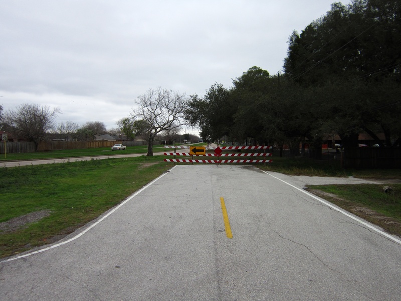
GOAR RD.
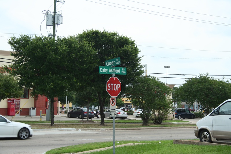
(Above photo: Intersection of Goar Rd. & Dairy-Ashford Rd. in May 2013)
Goar Rd. is the original name for the route now known as Briar Forest Dr. In the early 20th century, the road began at Addicks-Howell, which is now SH-6 South, and continued east until it intersected with Dairy-Ashford. It remained in this configuration until the end of the 1970's, when Briar Forest took over the Goar alignment. Only a small section of the original Goar still exists today. On the Northwest corner of Briar Forest and Dairy-Ashford, there is a small strip of asphalt road that was left behind when the Briar Forest alignment strayed away from the original Goar alignment. The old eastern end of Goar is still labeled, and considered an open street, though its only real purpose is providing back access to the strip center at the corner.
Photos from May 2013:
May 2013a 125.jpg : Facing east on Goar Rd. where it splits away from Briar Forest Dr. near Big John's Ice House.
May 2013a 126.jpg : Facing west where Briar Forest Dr. runs in the old footprint of Goar Rd.
May 2013a 128.jpg : The intersection of Goar and Dairy-Ashford (note the change from concrete to asphalt).
May 2013a 129.jpg : The intersection of Goar and Dairy-Ashford (same as header photo)
May 2013a 130.jpg : Facing south on Dairy-Ashford from Goar.
May 2013a 131.jpg : Facing west along Goar Rd. from Dairy-Ashford.
________________________________________________________________________________________________________________________________________________
GREENHOUSE RD.
(Above photo: Facing south along the original [offset] alignment of Greenhouse from Clay Rd., Dec. 2011)
Parts of Greenhouse Rd., which run through the Katy prairie in West Houston, are actually the original alignment for Barker-Cypress Rd., when it too was in its original configuration. All of this had to do with Barker-Cypress being realigned from a zig-zag fashion to a straight line running north/south. This realignment of Barker-Cypress took place during the 1980's, and connected Barker-Cypress from present-day Saums Rd. to present day Kieth-Harrow Blvd. The old Barker-Cypress alignment became a secondary (yet vital) roadway for local residents, so it was renamed Greenhouse Road, which is how our current Greenhouse Road began to take root. Today, Greenhouse has extended south from Saums to I-10, and north all the way to Cypress.
So what's the deal with "Old Greenhouse Road"?
After Barker-Cypress' realignment was completed in the 1980's, and the old secondary zig-zagging portion had taken the name "Greenhouse Rd.", residential development in Katy had begun to grow rapidly. Developers planned a northern extension of Greenhouse Road from Kieth-Harrow Blvd. to West Little York, to be built as a divided four lane boulevard. Because of this plan, the last part of the old Barker-Cypress alignment was renamed "Old Greenhouse Rd.", assuming that "New" Greenhouse Road was going to keep running north from Kieth Harrow. The only thing is...the project stalled out. For whatever reason, they only built a couple hundred yards of that northern extension of Greenhouse, and then it sat dormant; a dead end road for some 20 years. So basically Old Greenhouse Road is a secondary road for a second time. Prior to that extension in the 1980's, Old Greenhouse was just another part of Greenhouse, which was just another part of Barker-Cypress at one time.
GHR 010.jpg : A view along Old Greenhouse Road, which runs east/west and then north/south, and comes to a road now known as Gummert.
Realignment of the offset at Clay Rd.
Originally the Old Barker-Cypress (or Greenhouse) road had an offset intersection with Clay Road. The stretch of Greenhouse north of Clay was about 50 yards to the east of the southern stretch, and that offset was amended several times, according to historic aerial imagery from Google Earth and Historic Aerials.com. Apparently there were at least two attempts to make a smooth curve to eliminate the offset, and you can still see signs of the location of the original offset intersection. For example, the clearing in the trees, and the path of the long-established power line routes.
GHR 001.jpg : Facing south from Clay Rd. along the abandoned alignment of Greenhouse, 2011.
GHR 003.jpg : Facing south along the alignment where it merges with Greenhouse Rd., 2011.
GHR 009.jpg : Facing north from the active part of Greenhouse, with the abandoned portion directly ahead, as the power lines go, 2011.
__________________________________________________________________________________________________________________________________________________
HAYES RD.
Hayes Rd., which runs north from Westheimer, is not really a major road, but has been around for many decades. It used to be a two-lane asphalt road than trailed off into the rural prairie back in the 1940's, but since then, development has surrounded Hayes Rd., and when Wilcrest was first built, it crossed over into the Hayes Rd. right of way and continued north to Interstate 10. At the point where Wilcrest curves to the west and takes over the Hayes Rd. corridor, there is a small stump of the old road that was barricaded and left to deteriorate. I am uncertain as to the approximate year this barricade was set up, but it was prior to the 1970's, as the 1972 Exxon map of Houston shows Wilcrest already in place.
Aug 2015a 052.jpg : Facing north along the Hayes Rd. corridor where it dead ends at a barricade, Aug. 2015.
Aug 2015a 053.jpg : Facing north beyond the barricade, where the asphalt road surface vanishes into the grass, Aug. 2015.
Aug 2015a 051.jpg : Facing south along Hayes Rd. from the barricade. It is a back alley road to a strip center, and then the open road begins in the distance, headed towards Westheimer, Aug. 2015.
Aug 2015a 054.jpg : A close-up of the aged asphalt pavement along the abandoned part of Hayes, Aug. 2015.
________________________________________________________________________________________________________________________________________________________________________________________________________________________________
HILLCREST RD.
(Above photo: Hillcrest Rd. between 290 frontage road and Hempstead Rd., winter 2011 before construction began on 290)
Hillcrest Road was once a two-lane asphalt road that branched off of Hempstead Highway near the current intersection of the Sam Houston Tollway (Beltway 8). It dates back to the 1920's. When US 290 was constructed through the area during the late 1970's, Hillcrest Rd. was cut in half. It is not certain what the road originally led to, but my guess is that whatever used to be there was gone by the time construction of US 290 made it to the area, which was probably the reason the lower half of the road was abandoned.
The upper half remains open to traffic, and serves a few small businesses and homes, but comes to a dead end several blocks from the freeway. The lower half was rendered useless when a barricade was erected along Hempstead Highway where Hillcrest intersects it. The road signs were removed, and the road was eventually covered in gravel, presumably after the construction of the carpet & tile retailer that was built nearby during the 1990's.
The following photos were taken in 2011, before the remodeling of the 290 & Beltway 8 interchange. The abandoned road on the south side of 290 was erased by construction in the summer of 2013.
LYH 001.jpg : Abandoned lower half of Hillcrest, looking towards the barricade at Hempstead Highway.
LYH 002.jpg : Abandoned lower half of Hillcrest, looking north towards the crossing of US 290.
LYH 005.jpg : A closer look at the badly deteriorated road surface of Hillcrest Rd.
LYH 008.jpg : Active upper half of Hillcrest Rd, looking south towards 290. If not for the freeway, you would be able to see the beginning of the lower half of Hillcrest directly across the street.
LYH 009.jpg : Active upper half of Hillcrest Rd., looking north towards the dead end.
___________________________________________________________________________________________________________________________________________________
HILTONVIEW RD.
(Above photo: Facing west along the Hiltonview alignment from Hollister Rd., Jan. 2013)
Hiltonview Rd., in North Houston, is what I would consider to be a genuine abandoned road; remnants of an old road that has been completely forsaken as a viable roadway, and left to return to nature with no realignment at all. Hiltonview sits largely on the northwest corner of Sam Houston Tollway (Beltway 8) and Hollister Rd., but it also can be traced south of the tollway making a left turn into SH 249. On Google Earth, the road is labeled both Hiltonview and Mazen, and marked by a gray line, but today there is no road accessible to traffic.
The road first appears as a poorly defined path back in the 1940's, and then begins to look paved throughout most of the 20th century. In the late 1980's, the construction of the tollway bisected the road, and it seemed to have been deemed abandoned by then.
It appears that it was used by construction crews as an entrance to a site for a nearby drainage project during the early 2000's, and after that, it just kind of became dirt and grass. Today, it is almost totally overgrown on the north side of the tollway, and what remained of the south half was erased by recent construction along the tollway frontage road. I don't have a lot of facts on this road, most of what I know about this road is purely gathered from speculation and examination of the area. Because it didn't appear to connect with any significant roads or locations, it very well may have been a rural farm road spurring off from an ancient stretch of West Montgomery Rd. (the old name for SH 249). The following photos are from January 2013.
Jan 2013a 020.jpg : Link to the photo above showing Hiltonview facing west from Hollister.
Jan 2013a 021.jpg : Standing at the inside corner of Hiltonview facing east towards Hollister.
Jan 2013a 022.jpg : The construction entrance used at the corner of the road.
Jan 2013a 023.jpg : Some old tires that have been discarded alongside the road. Some are recent, others very old.
__________________________________________________________________________________________________________________________________________________
HOLZWARTH RD.
The realignment of Holzwarth Rd. in Spring, Tx. is a complicated one to explain, and equally difficult to photograph. The best way to see what happened is to look on Google Earth, and use the time travel feature to compare the original layout of the road with the modern road placement. Basically, some time during the 1970's, Holzwarth Rd. was realigned to smooth out an excessively winding section of the original road near the intersection of Louetta and I-45, and the remnant segments of road were renamed Old Holzwarth Rd.
Most of the realignment was done very neatly, leaving behind no portions of abandoned road to discover, so going to the location to take photographs was rather pointless, however I felt the need to at least give Old Holzwarth honorable mention, because thousands of drivers pass by it every day. I'm sure I wasn't the only one who wondered what the difference was between Old Holzwarth and new Holzwarth Rd.
__________________________________________________________________________________________________________________________________________________
HOUSE & HAHL RD.
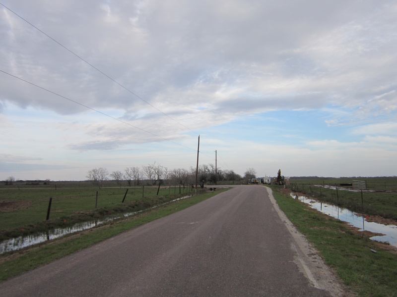
(Above photo: An original portion of House & Hahl that was bisected by Grand Parkway in Feb 2012. The left turn ahead is now a dead end.)
House & Hahl Rd. in far west Harris County is an old farm road that dates back to the late 19th century. It was relatively remote and lightly traveled until the early 2000's, when the rural scape of outer Cypress began seeing the first signs of urban sprawl. Neighborhoods like Black Horse Ranch and Bridgeland began springing up along the newly extended Fry Road corridor, and House & Hahl Rd. began seeing more traffic. The road could have been expanded and modernized, but because of its zig-zag design, it was left behind as an auxiliary road, still heavily used, but first in line to get hacked up in the interest of development. The first breakup of House & Hahl Rd. occurred around 2006 when a new community of Bridgeland built a manmade lake, which swallowed up a big portion of the road, as well as a good mile stretch of a new road called North Bridgeland Lake Parkway. There was a detour through the new community for House & Hahl traffic, as the road's continuity had been severed.
The road resumed on the north and south ends of the neighborhood. The north side went to Hempstead Rd., the south end went towards Katy-Hockley. In 2012, construction of the Grand Parkway SH-99 interrupted part of House & Hahl yet again. This time, a large segment of the road was bypassed when they built a completely new intersection for House & Hahl to intersect the Grand Parkway. Everything south of the new intersection was left as a dead end, and the newly built intersection included a portion of road that would connect with the original House & Hahl alignment that had been severed by the parkway construction. This all sounds very confusing, but if you look at a Google Earth aerial image of Grand Parkway at House & Hahl before and after the realignment, you will notice the vast amount of original road that was bypassed to make the current configuration work.
Everything west of the Grand Parkway still retains its original look. House & Hahl continues to function as a two-lane rural road, despite the heavy development that has cut it to pieces over the past ten years.
HHR 001.jpg : House & Hahl Rd. at its terminus at Hempstead Rd., March 2005
HHR 002.jpg: An old rice drier at House & Hahl and Hempstead Rd., March 2005. It was demolished in 2009.
Album 32 Pic 01.jpg : House & Hahl intersection with Hempstead Rd., June 2011.
Album 32 Pic 02.jpg : House & Hahl, crossing the railroad tracks near Hempstead Rd., June 2011.
Album 32 Pic 03.jpg : House & Hahl, southbound from Hempstead Rd., June 2011.
Album 32 Pic 04.jpg : House & Hahl, southbound from Hempstead Rd., June 2011.
Album 32 Pic 05.jpg : House & Hahl, southbound from Hempstead Rd. approaching Mound Rd., June 2011. Originally, Mound Rd. did not connect with House & Hahl, there was only a right curve up ahead.
Album 32 Pic 06.jpg : Facing west on House & Hahl at the location where Grand Parkway would cross, Feb. 2012.
Album 32 Pic 10.jpg : Facing east on House & Hahl at the location where Grand Parkway would cross, Feb. 2012. (Compare this with Jan. 2013a 044 to see the before & after effect)
Album 32 Pic 12.jpg : Old residential property along House & Hahl near Grand Parkway, Feb. 2012. This property remained intact after the E-segment opened to traffic, but it was a very close call.
Feb 2012a 039.jpg : House & Hahl Rd. dead end near Bridgeland community, Feb. 2012.
Feb 2012a 040.jpg : House & Hahl Rd. dead end near Bridgeland community, Feb. 2012.
Feb 2012a 041.jpg : House & Hahl Rd. dead end near Bridgeland community, Feb. 2012.
Album 32 Pic 14.jpg : The House & Hahl bridge over Big Cypress Creek, shown here closed due to structural concerns, Feb. 2012.
Album 32 Pic 15.jpg : The House & Hahl bridge over Big Cypress Creek, Feb. 2012.
Album 32 Pic 17.jpg : The House & Hahl bridge over Big Cypress Creek, Feb. 2012.
Album 32 Pic 18.jpg : The House & Hahl bridge over Big Cypress Creek, closed, Feb. 2012.
Jan 2013a 038.jpg : Facing south on House & Hahl at the new realignment for the Grand Parkway intersection, Jan. 2013.
Jan 2013a 039.jpg : The new intersection of House & Hahl and Grand Parkway, Jan. 2013.
Jan 2013a 040.jpg : A closer view of the new House & Hahl intersection at Grand Parkway, Jan. 2013.
Jan 2013a 041.jpg : Facing north on House & Hahl from the new realignment for Grand Parkway's intersection, Jan. 2013.
Jan 2013a 042.jpg : On the west side of the new House & Hahl realignment for Grand Parkway, Jan. 2013.
Jan 2013a 044.jpg : The west side of Grand Parkway, (facing east along original House & Hahl right of way), Jan. 2013. This is where a new extension of House & Hahl was built on the west side of the parkway to meet up with the original House & Hahl, which was bisected by the Grand Parkway.
Jun 2013a 074.jpg : Standing on the new Grand Parkway alignment facing a segment of House & Hahl on the west side, June 2013.
Jun 2013a 094.jpg : A new water tower under construction on House & Hahl near Bridgeland community, June 2013.
Jun 2013a 093.jpg : A new water tower (black & white) on House & Hahl, June 2013.
_______________________________________________________________________________________________________________________________________________
HUFFMEISTER RD.
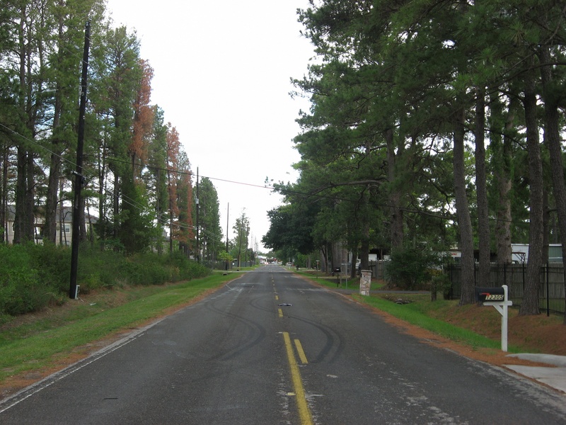
(Above photo: Old Huffmeister Rd., near Cypress-North Houston Rd., an old alignment that was bypassed in 1984. Shown here in 2011)
Huffmeister Rd. today is a lot longer than the original alignment, which once began at Hempstead Rd., and went only north from there. It was a main artery road through the Cypress area, going to places like the locally famous Tin Hall. Since the early 1980's, the road has undergone several expansions and realignments.
Around 1984, residential development in that part of Cypress prompted an extension of Huffmeister Rd. south of Hempstead Rd. going all the way to SH-6. On the north end, Huffmeister had a really troublesome offset at Cypress-North Houston Rd., where it resumed several hundred feet to the west. Up until this point, traffic in the area was not very heavy, and this offset of Huffmeister Road was not a big problem for traffic, but TxDOT built a new section of road linking the two halves of Huffmeister in a seamless transition.
Of course, the smoothing of the intersection left behind a portion of Huffmeister that was no longer part of the main road. It was renamed "Old Huffmeister", and remained open to traffic on both ends, allowing cars on Old Huffmeister to connect with the new alignment. In 2001, for some reason, the north end of Old Huffmeister was closed off permanently.
Album 21 Pic 19.jpg : Southbound on Huffmeister, facing the original alignment that intersected Cypress-North Houston., July 2011.
Album 21 Pic 21.jpg : The closed-off north end of Old Huffmeister, with the newer alignment in the background, 2011.
Album 21 Pic 24.jpg : The street sign at the intersection of Old Huffmeister and Cypress-North Houston, 2011.
Album 21 Pic 25.jpg : Facing north along Old Huffmeister from Cypress-North Houston, 2011.
Further north, another realignment was done near the intersection of Huffmeister and Telge in early 2006. In its original configuration, Huffmeister passed straight by Tin Hall, and came to a very acute (or obtuse, depending on which way you wanted to look at it) intersection with Telge, with Christ United Church of Cypress on the opposite side of the intersection. I remember traversing this intersection regularly as a child, riding in the family car out to Magnolia. In 2006, TxDOT realigned Huffmeister to curve to the west where it would intersect Telge at a 90 degree angle, about 6 or 7 blocks to the south of the original intersection.
What remained of Huffmeister Road going past Tin Hall was renamed Tin Hall Rd., and the south end was closed to traffic, effectively giving the historic dance hall its own private drive spurring off from Telge Rd. As Huffmeister continues to grow, Tin Hall Road will remain the same, sort of a historic chunk of road to go along with the historic dance hall. Huffmeister continued past Telge and zig-zagged through the land until it made a sharp right turn to the north, and became Cypress Church Rd. This lasted until 2012 when TxDOT connected East Louetta Road with the official end of Huffmeister.
HUFF 021.jpg : The sign for Tin Hall on Tin Hall Rd.which used to be Huffmeister Rd., 2011.
HUFF 022.jpg : Entrance to Tin Hall from Tin Hall Rd., July 2011.
HUFF 023.jpg : The original intersection of Huffmeister and Telge Rd., with Christ United Church across the street, July 2011.
On the south side of 290, Huffmeister had been extended to SH-6 in the 1980's, but construction stopped just a block or so on the south side of SH-6. It would have appeared that Huffmeister was planned to go all the way through the center of the Hearthstone community, because there was already a segment with the name "Huffmeister" in use as a neighborhood thoroughfare. For some reason, Huffmeister remained a dead end south of SH-6. There were even curbs built for it on West Road in anticipation of the extension through Hearthstone to FM 529. It would have also provided another entrance to the Copperbrook community. But it never happened. At least not yet. Perhaps some day, it will be a necessity.
HUFF 024.jpg : Facing south from SH-6 at Huffmeister, where Huffmeister has been a dead end street since the 1980's, July 2011.
Sep 2012a 052.jpg : The shoulder of West Rd. near Copperbrook, where Huffmeister would have intersected, Sep. 2012.
Sep 2012a 053.jpg : Facing south from West Rd. where the Huffmeister alignment was proposed to head towards Hearthstone, Sep. 2012.
Sep 2012a 054.jpg : Facing north from West Rd. where the Huffmeister alignment would run on the west side of Copperbrook, Sep. 2012.
Sep 2012a 055.jpg : Facing north along what would have been the northbound lanes of Huffmeister from West Rd. In the distance, Copperbrook is on the right, and a side entrance to the community would have likely been opened. Sep. 2012.
___________________________________________________________________________________________________________________________________________________
JACKRABBIT RD.
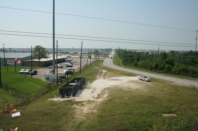
(Above photo: Facing south along Jackrabbit from SH-6, May 2013. Note the gravelly path once part of the original alignment)
Jackrabbit Rd. is a small road with a big story to tell. The road, which runs north/south in outer Northwest Houston, was named for the many jackrabbits that were seen in the area during the early 20th century. The area was predominantly rice and dairy farms as recently as the 1970's, before heavy settlement in the area really began. Jackrabbit originally began at FM 529, and ran north to Hempstead Rd. in the days before the 290 freeway.
At Hempstead Rd., Jackrabbit made a bend to the east along what is now known as the FM 1960 corridor, and continued all the way to the town of Bammel, near the present day intersection of FM 1960 and Kuykendahl Rd. In this original configuration, Jackrabbit was just another rural farm road, spanning only two lanes wide with drainage ditches on either side of the road. In 1951, TxDOT redesignated Jackrabbit as FM 1960, starting from Hempstead Rd.and everything east of it. However, the small portion of Jackrabbit Rd. that was south of Hempstead Rd. was not considered part of FM 1960, and remained its own road.
It was, however, still considered to be the primary northern road in the area if you were coming from Addicks to the Cypress area. The remaining segment of Jackrabbit was used in conjunction with Addicks-Satsuma Rd., which ran north from Addicks and then made a wild zig-zag pattern towards FM 529 starting in the Bear Creek area. It wasn't until the mid to late 1960's that TxDOT built State Highway 6 through the area, overtaking Addicks-Satsuma. SH-6 bypassed all the zig-zags, and continued due north all the way to Hempstead Rd. where it aligned perfectly with the western terminus of FM 1960. With this efficient maneuver, there was now a straight route from Addicks to Cypress, and both Jackrabbit Rd. and the zig-zag portion of Addicks-Satsuma were now rendered obsolete.
During this same project building SH-6, the new highway alignment interfered with the intersection of Jackrabbit Rd. at the railroad crossing. To remedy this, the northern tip of Jackrabbit was cut back about 150 feet, and curved to the west where it would spill out onto SH-6. If you visit the northern tip of Jackrabbit today, in front of the Waggoner's Trucking offices, you can still see the old bleached asphalt road surface heading on its original course toward the railroad crossing. Unlike FM 1960, Jackrabbit was never expanded from its original two-lane configuration. The corridor was fattened in some areas with left turn lanes, but the clearing for the road remains narrow, with ditches on either side of the road instead of curbs and embankments like modern roads.
Did you know?
Prior to 2002, the northern end of Jackrabbit Rd. was the site of Satsuma Station, a large oil storage and distribution facility located near Hempstead Rd. The facility was well recognized by local residents by the giant grid of silver storage tanks that were on the east side of the road, dating back to the 1950's. Most of these had been removed by 2002, and today a new industrial complex is being developed on the land that is reviving the name "Satsuma Station".
Jackrabbit Rd. was also the setting for the 1973 ZZ Top song "Master of Sparks". The song tells the allegedly true story of a bunch of rednecks who welded a round steel cage together and fitted a seat and seat belt inside it. The cage was placed in the back of a pickup truck and kicked out onto the street at 60 mph. The rider inside the steel cage was honored with the title "Master of Sparks" if they survived the ride. According to a 1976 interview, ZZ Top guitarist Billy Gibbons was one of those brave enough to ride.
May 2013a 032.jpg : A view of the original northern tip of Jackrabbit at Hempstead that was deleted and curved west, May 2013.
May 2013a 033.jpg : A view south along Jackrabbit from the SH-6 overpass, May 2013.
May 2013a 038.jpg : The present day ending of Jackrabbit at SH-6 below the overpass. (Overpass built in 1998).
JRR 001.jpg : A boarded up Diamond Shamrock that once sat at the northwest corner of Jackrabbit and FM 529, Jan. 2011. This structure was demolished in 2012 and a new store (Valero) was built in its place.
JRR 002.jpg : The northeast corner of Jackrabbit and FM 529, Jan. 2011.
JRR 006.jpg : Jackrabbit and West Rd. intersection, sometime in 2012.
JRR 007.jpg : The new FedEx facility that sits on what was once the storage tanks of Satsuma Station, 2012.
JRR 009.jpg : A view south along Jackrabbit Rd. showing the narrow configuration, and the tall trees tell the age of the corridor.
JRR 010.jpg : The north end of Jackrabbit near SH-6, facing along the original alignment where the current road curves away.
JRR 011.jpg : The old road surface that was part of the deleted northern tip from the late 1960's.
Nov 2014a 008.JPG : Traveling north on Jackrabbit towards SH-6, Nov. 2014.
Nov 2014a 009.JPG : Traveling north on Jackrabbit towards SH-6, Nov. 2014.
Dec 2014a 055.JPG : Traveling south on Jackrabbit Rd. towards West Rd., with Wagg Way Rd. on the left, Dec. 2014.
Dec 2014a 056.JPG : Intersection of Jackrabbit and West Rd., facing south along Jackrabbit, Dec. 2014.
__________________________________________________________________________________________________________________________________________________
KATY RD.
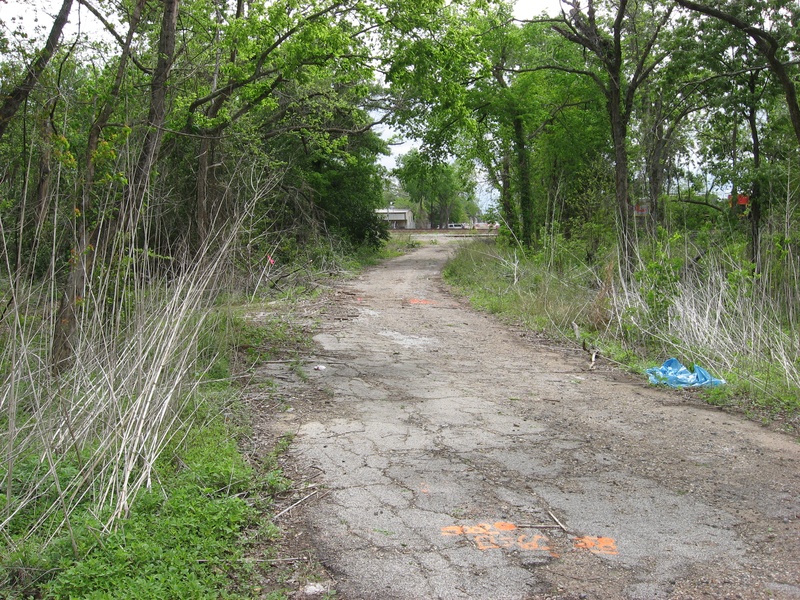
(Above photo: A closed off portion of the original Katy Rd. near the junction with Hempstead Rd. and Washington St., April 2013)
Today, we know Katy Rd. as The Katy Freeway, or part of I-10 running west from Houston, but the history of this mega freeway we now travel on starts off with a tiny, two-lane road that was originally called Katy Rd. The road began as a spur off of Washington St. prior to the turn of the 20th century. It most likely began with crushed oyster shell for paving, and then was upgraded to asphalt when that became the norm.
In the mid 20th century, when freeways began to appear across the nation, US Highway 90 was built through Houston following the Katy Rd. corridor. Katy Rd. remained open as a secondary road, and took on the name Old Katy Rd. Old Katy Rd. remained open into the late 2000's when the expansion of the Katy Freeway swallowed most of what was left of the original road, which had always run parallel to the freeway.
Today, there is virtually nothing left of the actual original alignment, but I found two locations where parts of Old Katy Rd. can still be seen. One lies on the northwest corner of I-10 and SH-6 near the Addicks Park & Ride; the other is just inside the 610 Loop where Old Katy Rd., Hempstead Rd., and Washington St. merge into one.
ADDICKS SEGMENT
The surviving segment near the Addicks Park & Ride confused me at first, because I couldn't understand how an expanding freeway would erase all of Old Katy Rd., but not this small segment which lies several yards to the north of the existing frontage road. The answer is a small curve in the road that placed this surviving segment slightly north of the rest of the old road, allowing it to escape the bulldozer by a very narrow margin. The curve was beneath the old Park & Ride ramp structure, which has since been demolished and rebuilt.
Apr 2013a 009.jpg : Facing west along Old Katy Rd. from the Park & Ride entrance along the I-10 frontage road.
Apr 2013a 010.jpg : Facing east along Old Katy Rd. from the same spot, where the asphalt has been removed.
Apr 2013a 012.jpg : Facing east along the Old Katy corridor. In the distance is the Park & Ride structure where the original curve in Old Katy Rd. used to be. The original Park & Ride structure was demolished and rebuilt to suit the newer freeway.
INSIDE THE 610 LOOP
The surviving segment inside the loop is where Katy Rd. first began, spurring off from Washington St. It intersected a railroad crossing, then made its way west. Some time in the 1950's, this original spur was bypassed by a newer road to the south, and the original Katy Rd. was closed off at the railroad crossing on both sides of the track. The two dead end sections of road still carry the name Old Katy Rd., but are just access roads for nearby businesses. On the east side of the railroad track, the road ends abruptly at the railroad corridor, and on the west side, there is a closed off portion of road that once descended from the railroad crossing. This closed off portion has been abandoned since the 1950's, and the deteriorated asphalt road surface has been almost completely consumed by nature.
Apr 2013a 001.jpg : The east side of the railroad track, facing west where the road once went over the track.
Apr 2013a 002.jpg : The east side of the track, facing back east towards town. The road is now just a business driveway.
Apr 2013a 003.jpg : Stop sign at the junction of new and old Katy Rd., facing south towards the Budweiser plant.
Apr 2013a 004.jpg : Facing west from the very beginning of Old Katy Rd. with the railroad crossing in the distance.
Apr 2013a 005.jpg : The abandoned portion of Old Katy Rd. on the west side of the railroad crossing, closed since the 1950's.
Apr 2013a 006.jpg : Facing west along the dead end part of Old Katy Rd. on the west side of the tracks.
Apr 2013a 007.jpg : A gate marking the closed off portion of Old Katy Rd. on the west side of the tracks.
__________________________________________________________________________________________________________________________________________________
KLUGE RD.
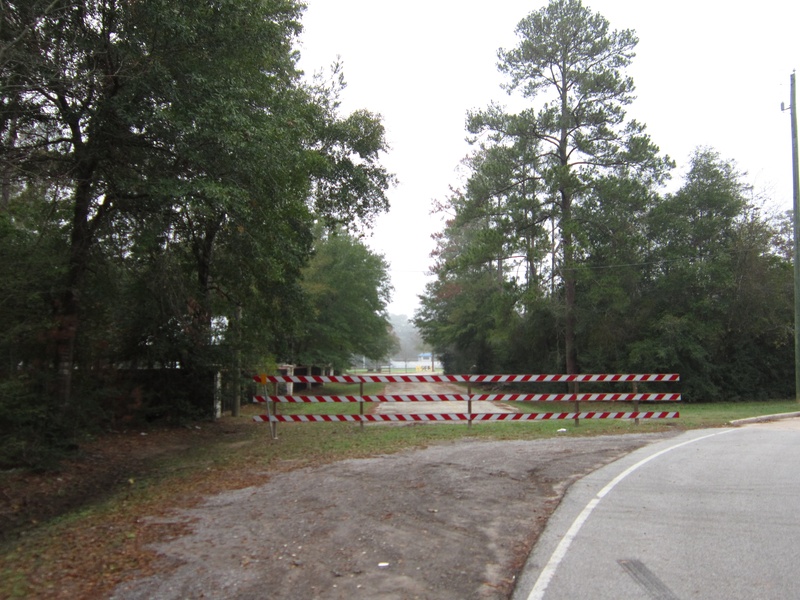
(Above photo: Facing the abandoned portion of Old Kluge Rd. from the active portion, Dec. 2011)
Kluge Rd. runs through Cypress between Huffmeister and Grant Roads, and was constructed sometime during the 1950's. It was a simple, two-lane asphalt road. In the early 1990's, Hamilton Elementary/Middle School was built, and the road configuration near Kluge and Grant was changed. The sharp turns on Kluge were bypassed by a new road called Malcolmson, which ran directly across the front of the new school's property. The eastern part of Kluge Rd. was renamed "Old Kluge Road", and left open only to serve the few private properties surrounding the road. Part of Old Kluge Road (pictured above) was blocked off to traffic and abandoned. I went out to photograph the old road on a cloudy winter day in late 2011, and shortly afterward, the main stretch of Kluge was widened from two lanes to four.
KLUGE 006.jpg : Looking north/northwest along the closed off portion of Old Kluge Rd.
KLUGE 004.jpg : The road surface of the closed off portion, which seems to be holding up fairly well.
KLUGE 011.jpg : Looking back south along Old Kluge Rd. from the abandoned portion.
KLUGE 008.jpg : The currently active portion of Old Kluge Rd., looking south.
_____________________________________________________________________________________________________________________________________________
KUYKENDAHL RD.
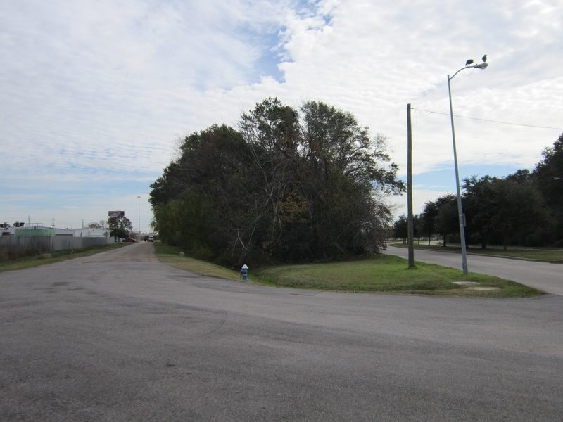
(Above photo: The split between old and new Kuykendahl Rd. The new road intersects Rankin, the old road meets I-45 directly.)
Kuykendahl Rd. in North Harris County runs north from I-45 all the way to Research Forest Dr. in the Woodlands. Originally, it appears to have ended at Schweinie Lake back when it was actually a lake. The road is well known as being a main road to the town of Bammel, which has long since been absorbed by the City of Houston, but once sat at the intersection of FM 1960 and Kuykendahl. The Bammel General Store was a familiar sight throughout the 20th century up to the end of the 1970's when it was finally torn down and replaced with a modern shopping center.
The southern end of Kuykendahl was realigned in the 1970's to relocate the intersection with I-45 (then known as US-75). Kuykendahl was curved south where it would intersect Rankin Rd., which would then lead to the freeway. The original section of Kuykendahl left behind after the realignment was left open to traffic as a side street, and given the name Mercedes Drive, no doubt in relation to the multitude of car dealerships that dot the area near Rankin and I-45.
Mercedes Drive, or Old Kuykendahl, whichever you like to call it, continues to exist in its original state, as most of Kuykendahl was until the late 1970's. Two lanes of asphalt paving with no curbs, only ditches on the sides, and tall trees that were once the common sight along Kuykendahl. It is not abandoned, just not well traveled. The dealerships use it to conduct vehicle brake tests for inspections.
KUY 024.jpg : The split between the old alignment (left) and the new alignment of Kuykendahl near Rankin Rd., 2011.
KUY 025.jpg : Some of the older infrastructure along the old Kuykendahl road, 2011.
KUY 026.jpg : The treeline that originally ran alongside the road before the realignment, 2011.
KUY 029.jpg : The southern tip of old Kuykendahl where it merges onto the I-45 frontage lanes just north of Rankin, 2011.
In 2007/08, construction began on a project to make Kuykendahl pass beneath FM 1960, relieving some traffic congestion that had been building since the late 1990's. It was finished some time in 2009, and though traffic on FM 1960 is always in bad shape, at least Kuykendahl traffic heading to and from I-45 doesn't have to be affected by it.
KUY 013.jpg : Kuykendahl Rd. at FM 1960 in 2008, before the digging beneath FM 1960 was done, facing north on Kuykendahl.
KUY 016.jpg : Kuykendahl Rd. at FM 1960 in 2008, facing north from the northbound lanes of Kuykendahl.
KUY 001.jpg : Kuykendahl Rd. at FM 1960 in 2009, same as previous photo after digging beneath FM 1960.
KUY 002.jpg : Another shot of the excavation work on Kuykendahl just south of FM 1960, March 2009.
_________________________________________________________________________________________________________________________________________________
LAMB RD.
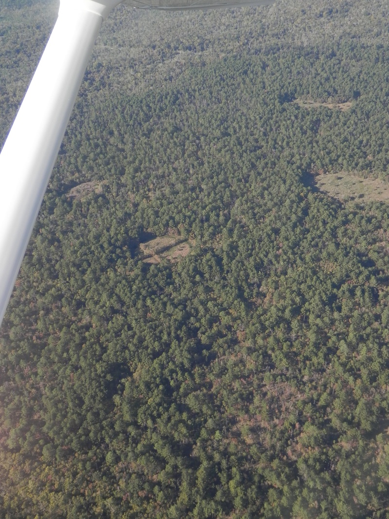
(Above photo: The "Cross of Trees" in Addicks Reservoir, which can only be seen from the air. It is part of some farm ruins along Lamb Rd., Nov. 2013)
Lamb Road has been one of my favorite subjects in my quest for abandoned roads of West Houston. Not because it yielded the best photography, but because it was the perfect example of a completely abandoned road. Lamb Road was not just a portion of a larger road that was bypassed and left to return to nature, but it was an entire street that used to be labeled on road maps, and has now vanished from existence, except for a small break in the guardrail along Eldridge Parkway, almost a mile south of Patterson Rd.
Lamb was quite possibly named after the landowner who first cut the trail to his property off of Addicks-Fairbanks Road during the early 20th century, but that remains to be discovered. All that I have been able to learn about Lamb Rd. was that it once led to a farm in the middle of what is now the Addicks Reservoir. Sometime during the 1940's, the land was bought out by the federal government for use as a flood control reservoir, and everything within its boundaries basically had to pack up and move, or face imminent flooding out during the next heavy rainfall.
That was probably the nail in the coffin for the little farm on the end of Lamb Rd., and as the decades passed, the useless road was eventually eliminated from local maps. Today, the road remains a scarcely defined path through the trees on the western shoulder of Eldridge Parkway, but there is a property gate, and not many places to park a car if you're thinking about taking a hike to the old farm site.
Excuse the crude Google snapshots, until I have a good chance and weather to explore this area, all I have are online references to illustrate the location of this old road.
LAMB 001.jpg : Google Earth image of Lamb Rd. and the farm in 1943.
LAMB 002.jpg : Google Earth image of Lamb Rd. and the farm in 1989.
LAMB 003a.JPG : Google Earth image of Lamb Rd. as it looks in 2011, with the road highlighted, as well as an unusual circular fish farm divided into four quadrants that has been the topic of speculation among local history enthusiasts.
Nov 2013 046.jpg : An aerial photograph of the "cross of trees" in the middle of the reservoir, off of Lamb Rd., as it looks in November 2013.
___________________________________________________________________________________________________________________________________________________
LAUDER RD.
Lauder Rd. is actually on the east side of town, not my self proclaimed jurisdiction, but I found an abandoned segment of Lauder Rd. just a few blocks east of JFK Blvd. There was a sharp turn in the road in very old images on Google Earth, and sometimes during the mid 20th century, the road was smoothed out, leaving behind some old roadwork remnants in the fields. Based on the condition of the pavement on the abandoned stretch of road, I would estimate it to have been done in the 1960's or possibly earlier. I took some photos one day on a discovery drive, see for yourself.
Apr 2013a 076.jpg : Facing east along the old alignment, east of JFK Blvd.
Apr 2013a 077.jpg : Facing east along the old alignment, zoomed in.
Apr 2013a 078.jpg : The pavement condition of the old alignment.
Apr 2013a 080.jpg : The abandoned road segment in relativity to the new Lauder alignment, facing east.
__________________________________________________________________________________________________________________________________________________
LOU EDD RD.
(Above photo: The old bypassed portion of Lou Edd, which sits behind the Kroger at Jones Rd. & Cypress-North Houston Rd., March 2015)
Lou Edd Rd. in Cypress is not a very old road at all, compared to the roads that surround it. The road is short, running east/west providing a link between Jones and Perry Road. The road appears to have been built in the 1950's or 1960's, and was a straight line on both ends. Around 2002, the west end of Lou Edd at Jones was realigned to the north to connect more smoothly with Cypress-North Houston, which came to an end just a few blocks away from the original Lou Edd intersection. After the realignment, eastbound traffic on Cypress-North Houston could now cross Jones Road directly onto Lou Edd, and take it all the way to Perry. Unfortunately, I never got the opportunity to get photographs of Lou Edd before the realignment. It was an insignificant road, and I was not even aware of the changes until many years later.
One interesting fact about Lou Edd Rd. is that it once led to a residential airstrip known as "Flying Acres". It consisted of about six or seven houses that shared a private grass airstrip, which has now been defunct for some time. The airstrip itself can still be pointed out on aerial photos from Google Maps or Earth.
LOU 008.jpg : The western end of Lou Edd where the realignment was done, facing east, Dec. 2011.
LOU 009.jpg : Facing west along the original alignment of Lou Edd, which now runs directly into a Kroger shopping center, Dec. 2011.
LOU 011.jpg : Facing west along the original alignment of Loue Edd, further back from a nearby neighborhood entrance, Dec. 2011.
Mar 2015a 026.JPG : Facing east along Lou Edd from Jones Rd., March 2015.
Mar 2015a 027.JPG : Facing east along Lou Edd from Jones Rd. (zoomed in), March 2015.
Mar 2015a 028.JPG : Facing west across Jones Rd from Lou Edd., where it changes to Cypress-North Houston Rd., March 2015.
Mar 2015a 029.JPG : Lou Edd Rd., viewed from the backside of the Kroger grocery store, March 2015.
Mar 2015a 030.JPG : Lou Edd Rd., facing east from the Kroger shopping center, March 2015.
Mar 2015a 031.JPG : Facing east along the old bypassed section of Lou Edd, situated behind the Kroger shopping center, March 2015.
Mar 2015a 032.JPG : Another view facing east along the bypassed section of Lou Edd, zoomed in towards Rockharbor Ln., March 2015.
Mar 2015a 033.JPG : The old asphalt surface of Lou Edd Rd., where the surviving west end runs into a private property gate, March 2015.
Mar 2015a 034.JPG : Facing west along the old right of way for Lou Edd, which is now private property with no telltale intersection with Jones Rd., March 2015.
Mar 2015a 035.JPG : Lou Edd Rd. at Rockharbor Ln., a residential artery street that will end up being altered when Lou Edd is expanded. March 2015.
Mar 2015a 036.JPG : Facing west along the old bypassed right of way from Rockharbor Ln., March 2015.
Mar 2015a 038.JPG : Facing east along the old right of way from Rockharbor Ln., March 2015.
Mar 2015a 042.JPG : Facing west along Lou Edd Rd. from Holly Stone Dr., which is the street that borders Flying Acres on the west. March 2015.
Some old Google Earth images I saved to illustrate three stages of the life of Lou Edd Rd.
LOU 003.jpg : Before (1953)
LOU 004.jpg : First alignment (1978)
LOU 005.jpg : After realignment (2004)
Flying Acres: What remains today (as of 2015)
Mar 2015a 039.JPG : Facing west along the old grass runway from Perry Rd., March 2015.
Mar 2015a 040.JPG : Facing west along the old grass runway from Perry Rd., March 2015.
Mar 2015a 041.JPG : Driving along Lou Edd Rd. near Perry, where the houses reside that are associated with the Flying Acres community, March 2015.
__________________________________________________________________________________________________________________________________________________
LOUETTA RD.
(Above photo: Old Louetta Loop, on the north shoulder of Louetta, west of Kuykendahl. This is facing west from the westbound lanes, April 2014)
Along the sides of Old Louetta, there are some small businesses and a few older homes that clearly existed before the realignment. Some of them appear vacant, but on the day I went out to get photos, I saw a truck coming and going from one of the derelict homes nearby.
The following photos were taken in April 2014:
Apr 2014a 006.JPG : Link to the image above
Apr 2014a 007.JPG : A zoomed in view of the same as above
Apr 2014a 008.JPG : The dead-ended east end of the old Louetta segment. Note the old house behind it.
Apr 2014a 005.JPG : Another view of the east dead-end of the old Louetta segment.
Apr 2014a 009.JPG : This view of the old road from new Louetta gives the illusion of how it probably looked forty years ago.
Apr 2014a 001.JPG : Facing east along the Old Louetta loop segment.
Apr 2014a 002.JPG : Facing west along the Old Louetta loop segment.
_________________________________________________________________________________________________________________________________________________
MANGUM RD.
At the multi-junction of W. 43rd St., Randon Rd., Mangum, and the nearby railroad corridor, I discovered the remnants of an old part of Mangum Rd. in late 2014. I could not pin the exact year, but it appears that this reconfiguration of the intersection took place sometime in the 1950's when the nearby suburbs were being built. Around the time W. 43rd. St. cut through the junction of Mangum and Randon, a small piece of Mangum that was situated between W. 43rd. and the railroad tracks was eliminated from active use. Mangum resumed south of the railroad, but was now bisected at W. 43rd.
All that remains today is a small, nameless slab of asphalt covered in litter, but this was once part of Mangum Rd. long ago. I photographed it in early January of 2015.
Jan 2015a 001.JPG : Facing south along Mangum Rd. across W. 43rd St. Beyond the barricade lies the abandoned segment of old Mangum Rd.
Jan 2015a 002.JPG : The intersection of W. 43rd St. and Mangum, facing east/northeast along W. 43rd.
Jan 2015a 003.JPG : The view of the abandoned road segment as it appears from W. 43rd St.
Jan 2015a 004.JPG : Facing south along the abandoned strip of Mangum. The road continues on the other side of the tracks.
Jan 2015a 005.JPG : Another view south along the abandoned strip.
__________________________________________________________________________________________________________________________________________________________________________________________________________________________________
W. MONTGOMERY RD. (FM 149/SH 249)
(Above photo: SH-249 where it veers east from the W. Montgomery corridor onto the W. Mount Houston corridor, July 2012)
W. Montgomery Road is the original name given to the corridor that is now occupied by SH-249, or Tomball Parkway. During the mid to late 20th century (still not certain of the exact year), FM 149 was extended through North Houston all the way to US-75 (I-45), and it used the Montgomery Road corridor, which began at the junction of Stuebner-Airline and W. Hamilton, and took you to the town of Montgomery.
The only thing was, the FM 149 overtaking didn't follow the Montgomery corridor all the way into town. At the intersection of Mount Houston Rd., FM 149 took a turn to the east and followed that corridor to the North Freeway. This is what gives us that smooth left curve when we head towards I-45 via Tomball Parkway. And it's this area of land that this chapter focuses on.
One interesting thing to note is that south of this curve, W. Montgomery Road still exists in its original form, heading south through Acres Homes towards W. Hamilton, just another two lane road leading to and from Houston. It was purely by circumstance that this small portion of the original Montgomery corridor was left to survive, as the rest of it was turned into a highway, which later became a freeway (SH-249) in 1988.
One thing I discovered while researching the area was that there were a few neighborhood streets that were cut in two by the building of the FM 149 highway bend onto W. Mount Houston. Washington and Lincoln Drives were two residential streets spurring off of W. Montgomery, and when the FM 149 highway was built through the area, it chopped off the west end intersections with W. Montgomery Rd. The intersections exist today, but Washington Drive is just an access point to SH-249, and Lincoln Drive at W. Montgomery is just a dead end.
JULY 2012
Jul 2012a 092.jpg : Traveling westbound on SH-249 from I-45, along the old W. Mount Houston corridor, approaching the bend where SH-249 follows the old W. Montgomery corridor. If you follow the power lines on the left, you can see an old corridor with an oncoming vehicle in view. This was once part of Mount Houston Rd. before it was overtaken by FM 149.
Jul 2012a 093.jpg : The 149er bar at the curve on SH-249, a sign of the former highway that once occupied the area.
Jul 2012a 095.jpg : Facing east from W. Montgomery Rd. at the curve where FM 149 overtook W. Mount Houston Rd.
Jul 2012a 096.jpg : The dead end of Lincoln Dr., a street that resumes on the opposite side of SH-249.
Jul 2012a 098.jpg : The west half of Lincoln Dr on the west side of SH-249, facing east from W. Montgomery intersection.
Jul 2012a 097.jpg : The intersection of W. Montgomery and Lincoln Dr., now a pointless intersection.
_________________________________________________________________________________________________________________________________________________
NOBLE RD.
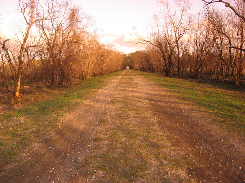
(Above photo: The Noble Hiking Trail, formerly Noble Rd. before the days of asphalt roads, Dec. 2011)
Noble Rd. was one of several historic roads that ran through the land that is now consumed by the Barker Flood Control Reservoir, in West Harris County. Along with Addicks-Clodine, Barker-Clodine, and Beeler, Noble Rd. was part of a network of old paths that have ceased to exist as "roads" in modern times. However, the path carved out by Noble Rd., which is primarily a horizontal line, was turned into a hiking and biking trail several decades ago, and is a great way to get into the center of the Barker Reservoir for exploring nature.
The trail is best located if you can first find Briar Forest Drive where it meets SH-6 on the east side of the reservoir. The Noble Trail is almost directly across the road from Briar Forest. There is plenty of parking, and the public is encouraged to hike, jog, or bicycle along this historic path.
Many are aware if the trail's existence, but few know of its origins as a road that dated back to the turn of the 20th century, long before the Barker or Addicks Reservoirs even existed. It starts off as a gravel laden path, but eventually turns to grass and dirt, and is a great way to gain access to the long abandoned Addicks-Clodine Road.
Aug 2012 064.jpg : This is the beginning of Noble Rd. at South Highway 6, across from Briar Forest. Prior to the construction of the Barker Dam, the road was flat. The current paving over the hill was originally done in the 1940's.
ACR 020.jpg : Looking west along Noble, about 20 yards from the intersection of Addicks-Clodine.
ACR 021.jpg : Looking west along Noble at a fork in the trail. The path to the left leads to an open area with some very old tankers that appear to have been in the same spot for over 60 years. White tail deer can often be spotted near this clearing.
ACR 022.jpg : Looking east, heading back towards the parking lot along SH-6.
ACR 019.jpg : Looking east.
___________________________________________________________________________________________________________________________________________________
NORTH BELT DR.
(Above photo: A stretch of Old North Belt Drive on the south side of Beltway 8 near Mesa Dr. in Humble, July 2014.)
Now known today as Old North Belt Dr., this half-abandoned, half-in use segment of road is an old remnant of the divided four lane highway that predated the Sam Houston Tollway through Humble. During the late 1980's, the main lane construction of Beltway 8 came through the area, taking over North Belt Dr., which was built in the 1970's as a precursor to the planned Beltway 8. For some reason, the right-of-way for the new freeway deviated from the North Belt Dr. corridor at this location, leaving behind two sections of the old road, east and west of Mesa Dr.
SECTION 1
This road is located on the southwest corner of Beltway 8 and Mesa Dr. It is four-lanes wide, two in either direction, with enough corridor width to build a freeway. At least that was the original plan when North Belt Dr. was built. This corridor was bypassed in the 80's, and the road was left open to traffic, but only accessible from a few places. The grass is overgrown, but the tall trees on either side of the road made it feel more like an old freeway, like going back in time. Perhaps this is what West Belt Drive might have looked like today if any portions had survived the construction period.
Jul 2014a 044.JPG : The western cut-off of this segment of road, just west of Old Humble Rd. Facing west, July 2014.
Jul 2014a 045.JPG : Facing east on Old North Belt Dr. from the western cut-off, Old Humble Rd. crossing in the distance, July 2014.
Jul 2014a 046.JPG : Standing on the western end of Old North Belt Dr. facing north at where the freeway right of way came through, July 2014.
Jul 2014a 048.JPG : The absolute dead end of the western segment. On the other side of the barricade is an old railroad crossing, July 2014.
Jul 2014a 049.JPG : Peeking beyond the western barricade at some of the abandoned remnants of road left behind, July 2014.
Jul 2014a 050.JPG : The view east from Old Humble Rd. This is how the entire North Belt looked until the tollway was built., July 2014.
Jul 2014a 051.JPG : The view west (at the dead end) along North Belt Dr., July 2014.
Jul 2014a 052.JPG : Street sign for Old North Belt Dr. at Elmtex Dr., July 2014.
Jul 2014a 054.JPG : Old North Belt Dr., facing west from Hickorytex Rd., July 2014.
Jul 2014a 055.JPG : This is where the tollway main lanes cut through North Belt Dr. on the east end of this segment. On the other side of the freeway, this same alignment resumes east for a while. July 2014.
Jul 2014a 056.JPG : This is the continuation of the alignment from the previous link, as it appears from Mesa Dr. facing east, July 2014.
SECTION 2
This road is located on the northeast corner of Beltway 8 and Mesa Dr. This half of Old North Belt Dr. is only a two lane road, nothing like the western segment. From what I could gather, it looks like there was already a two lane road in place here when they began building the four lane North Belt Dr. back in the 1970's. The construction never made it all the way east of Mesa Dr. before the Beltway 8 freeway came through and changed priorities. This half of Old North Belt Dr. looks much more rural than its western counterpart. It has wide grassy shoulders that are well manicured, and there are old houses and an elementary school positioned alongside the road.
Jul 2014a 057.JPG : The eastern segment, facing west towards the cut-off barricade at Beltway 8. July 2014.
Jul 2014a 058.JPG : A closer look at the same barricade, east of Mesa Dr., July 2014.
Jul 2014a 059.JPG : Facing east along Old North Belt Dr. eastern segment, July 2014. Notice this half of the road is only two lanes wide.
Jul 2014a 060.JPG : North Belt Elementary School, located right off the eastern segment. Notice the old style pre-fab drainage culverts.
Jul 2014a 061.JPG : Approaching the end of the eastern segment where it catches up with the Beltway 8 alignment again, July 2014.
Jul 2014a 062.JPG : This lip of concrete on the end of the eastern segment marks the path of the original North Belt alignment where it ventured into the path of Beltway 8 construction many years ago. July 2014.
_________________________________________________________________________________________________________________________________________________
NORTH HOUSTON-ROSSLYN RD.
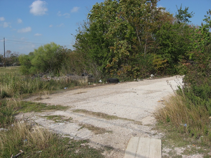
(Above Photo: Abandoned segment of the old North Houston-Rosslyn Rd. on the southeast corner of SH-249 and modern N. Houston-Rosslyn, 2011)
Another good example of an abandoned road is the old northern tip of North Houston-Rosslyn Rd. near SH-249. The road itself dates back to the early 20th century, and has undergone two major realignments since the 1940's.
Back when SH 249 was known simply as Montgomery Rd., North Houston-Rosslyn made a sharp turn to the east as it crossed over a creek, and then back to the north where it then came to an intersection with Montgomery Rd. Sometime between 1944 and 1953, the two sharp turns were smoothed out by an S-curve, which featured a wooden bridge at the creek.
NHR 001.jpg : Google Earth image showing the northern end of North Houston-Rosslyn as it looked in 1944, facing north. In this photo, the road has two sharp turns as it crosses over the creek. This was changed when the S-curve was added, presumably in the early 1950's.
After several decades of operating with the S-curve, North Houston-Rosslyn was realigned to the west by a four lane divided road that intersected SH 249 directly across from Bammel-North Houston Rd. This was done during the 1970's, leaving behind a portion of the old road. The original bridge across the creek was demolished in the late 1970's, but there are still some wooden posts sticking out of the water to this day.
NHR 002.jpg : Google Earth image showing the same spot as the above photo, but from 2011. In this aerial image, North Houston-Rosslyn has been realigned to the far left, leaving behind the original two-lane road. The old bridge is gone, and the lower portion of the old road was converted into a driveway for a nearby church. The northern half of the road was left abandoned, and is now overgrown with trees. The abandoned section is used as an illegal trash dump site for old furniture and car parts, and also as a walkway for residents of the nearby apartments to cut through the field to the stores along SH 249.
NHR 012.jpg : This is the southern edge of the original North Houston-Rosslyn Rd. The bridge would have been on the left of the photo if it were still in existence. A pile of earth keeps stray vehicles from accidentally driving into the creek.
NHR 012.jpg : Looking into the creek, some of the old wooden bridge supports can be seen poking out of the water in the center of the photo.
NHR 005.jpg : Looking north towards the abandoned section of North Houston-Rosslyn from the southern half, which is still used as a church driveway. The street that crosses left to right in the photo is Smiling Woods Ln.
NHR 010.jpg : Looking south across Smiling Woods Ln. at the southern half of the old road, which is now the church driveway. The beginning of the abandoned half is in the lower edge of the photo.
NHR 006.jpg : The start of the abandoned road, which is heavily littered with car parts.
NHR 007.jpg : Looking north along the abandoned road.
NHR 009.jpg : Midway along the abandoned road. Notice the faint yellow lane divider paint.
NHR 016.jpg : At the northern tip of the abandoned road, looking back (south).
NHR 018.jpg : At the northern tip, looking back (south), from the side of the road, to illustrate the growth on the sides of the road.
__________________________________________________________________________________________________________________________________________________
NORTH SHEPHERD DR.
(Above photo: Facing south along North Shepherd Dr. at the railroad underpass between 34th and 38th Streets, Jan. 2015.)
If you have spent enough time in the Heights area, you should be familiar with the part of North Shepherd that dips beneath the railroad corridor between 34th and 38th Streets, near the old Garden Oaks Theater. Surrounding this underpass on all four corners are the remains of what looks to have been an older configuration of North Shepherd Dr. These road segments are at ground level, and closed off at the railroad tracks on all corners. The northeast corner was erased by a parking lot, but the other three corners still have old road alignments that survived to the present day. But they no longer cross the railroad, or serve as viable thoroughfares.
I am a bit unsure of the original configuration, because the oldest aerial photos from the 1940's show the underpass had already been built. They may have been secondary roads, similar to a frontage road/main road configuration, but only a handful of people may know the full story behind this bizarre intersection.
Jan 2015a 025.JPG : Facing south along North Shepherd from 38th St. On the left is the current underpass, on the right is the old road, which runs into a dead end at the railroad tracks.
Jan 2015a 023.JPG : Facing south along the old part of North Shepherd (the northwest segment).
Jan 2015a 022.JPG : The dead end of the northwest segment. Across the tracks is the southwest segment, which once merged back onto the main road.
Jan 2015a 021.JPG : Facing back north along the northwest segment at Sue Barnett Dr., a neighborhood street that connects to the old North Shepherd Dr.
Jan 2015a 026.JPG : This is the southwest segment, which once connected to the northwest segment but is now barricaded.
Jan 2015a 027.JPG : Facing north across the railroad tracks at the barricade for the northwest segment (the subject of photo 022 above)
Jan 2015a 028.JPG : The barricade for the southwest segment, facing south.
Jan 2015a 029.JPG : Facing south along the southwest segment where it once merged back into the main road.
_________________________________________________________________________________________________________________________________________________________________________________________________________________________________
PERRY RD.
Perry Road is a relatively short road, spanning only the length between Fallbrook and SH-249 in North Harris County, but it has become a major intersection at FM 1960, and according to historic aerial images, it appears that Perry Road once had something to do with Jackrabbit Rd., the predecessor of FM 1960. Old aerial images on Google earth as far back as 1943 show Jackrabbit Road making a curve to the north where Perry Road is today. From there, it crosses Grant and heads for FM 149. I am still trying to figure out what exactly happened here, but my best guess is that Jackrabbit Road once turned north at this point, and made its way to FM 149 to intersect the highway further north than FM 1960 does today.
After the FM 1960 intersection with FM 149 was opened, the original northern end of the Jackrabbit corridor was renamed Perry Road. There was also a slight offset of Perry Road at Mills Road, which was smoothed out in the early 1980's. It left behind a short stub of road at the northeast corner of Perry & Mills, but the 2011 expansion of Perry Rd. into four lanes erased the last remaining evidence of the old offset.
Some photos from March 2010 during the expansion to four lanes.
PER 001.jpg : Facing north from FM 1960
PER 002.jpg : Facing south towards FM 1960 from Perry
PER 003.jpg : Facing north on Perry from Pine Pass
PER 004.jpg : Facing north of Perry from Pine Pass
PER 005.jpg : USA Car Care on Perry Rd., which lost some real estate to the expansion
PER 006.jpg : Construction workers working on the new southbound lanes of Perry
PER 007.jpg : Facing north on Perry at Lou Edd Rd.
PER 008.jpg : Perry & Mills Rd., facing south on Perry from Mills Rd.
PER 009.jpg : Facing south along Perry from Mills Rd.
PER 010.jpg : Perry & Mills Rd., June 2011, facing the north side of the intersection.
__________________________________________________________________________________________________________________________________________________
ROARK RD.
Roark Rd. was a small, two-lane country road that ran north/south between US-59 and Westpark Dr. It ran on the same longitude as West Belt Dr., but the two roads did not intersect. Between Westheimer and Westpark Dr. is a small street called Rogerdale, which helped tie Roark Rd. to West Belt Dr. In the late 1980's, when the Sam Houston Tollway/Beltway 8 began construction, the right-of way overtook both West Belt Dr. and Roark Rd. The only portion of Roark that survived the construction of the tollway is the very southernmost segment right before it meets the westbound US-59 frontage road. That little portion of Roark Rd. is also tied to the southbound Beltway 8 frontage road, and it provides a shortcut from one frontage road to the other.
Looking at the two-lane asphalt road, it should give an idea of what the rest of it probably looked like in the days before we had the tollway. At this time I don't have any pictures of Roark Rd. to share, but I plan to add some of what remains today. As for the little tie-in street called Rogerdale, it remains in use today because it was out of the path of the tollway construction, thanks to it having been jogged slightly west of West Belt & Roark.
___________________________________________________________________________________________________________________________________________________________________________________________________________________________________
SPENCER RD./FM 529
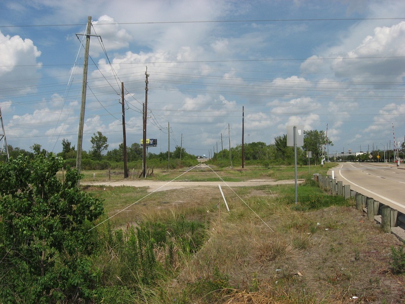
(Above photo: Facing east along the abandoned corridor of FM 529/Spencer Rd. near US 290 in summer 2011, with lines to indicate the path of the road)
Farm to Market Road 529, originally known as Spencer Rd., begins at US 290 and goes west to Bellville, TX. The original road began at Hempstead Road in the days before the 290 freeway. It crossed some railroad tracks, passed the Farmers Rice Drier on the left, and made a straight line for Bellville. It was only two lanes wide and paved with asphalt. In the late 1980's, the construction on the 290 main lanes had reached the Jersey Village area, and the intersection of FM 529 was moved south, where it would bypass the railroad crossing, and intersect 290 below grade level.
The old intersection, and the railroad crossing, were abandoned for 24 years. The rice drier was demolished at some point, and the land was overgrown and unkempt. It became a trash-dumping site where people would dispose of old hot tubs, appliances, and furniture. I never even knew the abandoned road existed until 2011 when I began searching for them in my local area. Only a few years after I discovered the abandoned original end of FM 529, construction crews for the upcoming 290/Beltway 8 project came in and cut down all the overgrowth, bulldozed the land, and used the old road as a driveway to a concrete mill. But for a short while, I was able to appreciate the original look of the east end of FM 529, and capture it in photos.
Summer 2011:
FM529 004.jpg : Facing east on the abandoned original FM 529 corridor near US 290, July 2011.
FM529 005.jpg : Facing east on the abandoned road near a faded railroad crossing marker, July 2011.
FM529 006.jpg : Facing east on the abandoned road, closer to the 290 frontage road and railroad tracks, July 2011.
FM529 007.jpg : The original start of FM 529 at the Hempstead corridor railroad crossing, now just piles of trash & debris.
FM529 008.jpg : Facing east on the abandoned road (going in reverse because I couldn't make a U-turn), July 2011.
October 2011:
FM529 011.jpg :Facing east on the abandoned road, Oct. 2011.
FM529 012.jpg : Facing west on the abandoned road where the present day alignment merges onto the original corridor, Oct. 2011.
FM529 013.jpg : A stub of asphalt from the old FM 529 (facing west) that was left over after the old corridor was disconnected.
FM529 014.jpg : Facing west from the starting point of the abandoned FM 529 at the railroad crossing, Oct. 2011
FM529 015.jpg : The point where FM 529 crossed the railroad tracks and intersected Hempstead Rd./US 290.
FM529 016.jpg : Another view of the railroad crossing, where the end of the road is blocked off by concrete barricades.
FM529 017.jpg : A view along the railroad corridor from the abandoned end of FM 529, Oct. 2011.
FM529 018.jpg : Another view facing west from the start of the abandoned road, showing all the overgrowth of shrubs, Oct. 2011.
February 2012:
Feb 2012 034a.jpg : Black & white photo facing east along abandoned FM 529 in February 2012.
Feb 2012 035.jpg : Panoramic shot of abandoned FM 529 facing west at what used to be the driveway to the Farmers Rice Drier.
Feb 2012 043.jpg : Discarded trash on the abandoned road where the entrance to Farmers Rice Drier used to be,
Feb 2012 044.jpg : More discarded trash (including hot tubs) littering the sides of the abandoned road.
March 2013: (This is when road crews came in and cleared the land of all overgrowth and debris to make room for a concrete mixing site)
Mar 2013a 029.jpg : Facing east towards US 290, all overgrowth has been removed.
Mar 2013a 030.jpg : Facing west along the abandoned road at sunset, with all the overgrowth cleared away.
Mar 2013a 031.jpg : This concrete structure was the foundation for the Farmers Rice Drier, which was removed in the 80's.
Mar 2013a 032.jpg : Another view of the old foundation structure, the west building.
Mar 2013a 033.jpg : Another view of the old foundation structure, the west building.
Mar 2013a 034.jpg : The foundation of the east building nearer to 290, which had some sort of weigh scale.
Mar 2013a 036.jpg : Another photo of the remains of what I assume to be a weigh scale on the east building.
Mar 2013a 037.jpg : Facing east at the end of the abandoned road near 290, with Sprint phone lines marked by spraypaint.
Mar 2013a 038.jpg : The land surrounding abandoned FM 529 after it had all been cleared away.
March 2016: The abandoned alignment has now been used for construction purposes for several years, and is no longer a mystery site for abandoned road seekers like me.
________________________________________________________________________________________________________________________________________________
SPRING-CYPRESS RD.
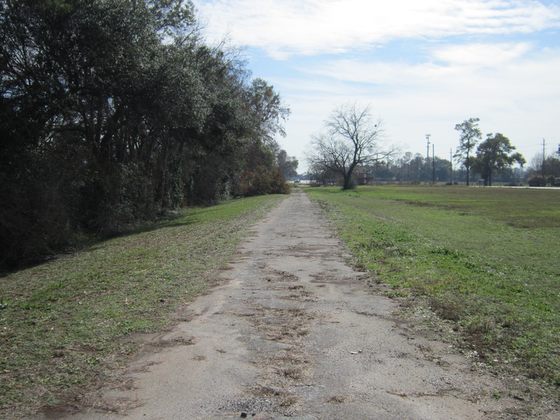
(Above photo: Abandoned part of the old Spring-Cypress Road east of Stuebner-Airline, facing south with new alignment on the right, Dec. 2011)
Spring Cypress Road, which dates back to the late 19th century, was the primary link between the towns of Spring and Cypress. The road has an eastern terminus in what is now Old Town Spring, and a western terminus at Cypresstop, the old railroad stop from which the town of Cypress blossomed. Although Spring Cypress Road has been the subject of many repavings, widenings, and realignments, the most notable one lies just a couple of miles east of Stuebner-Airline Rd. near the current intersection of T.C. Jester.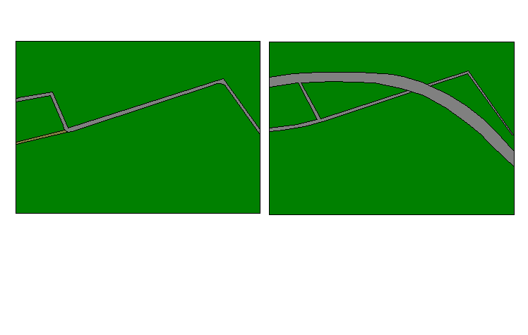
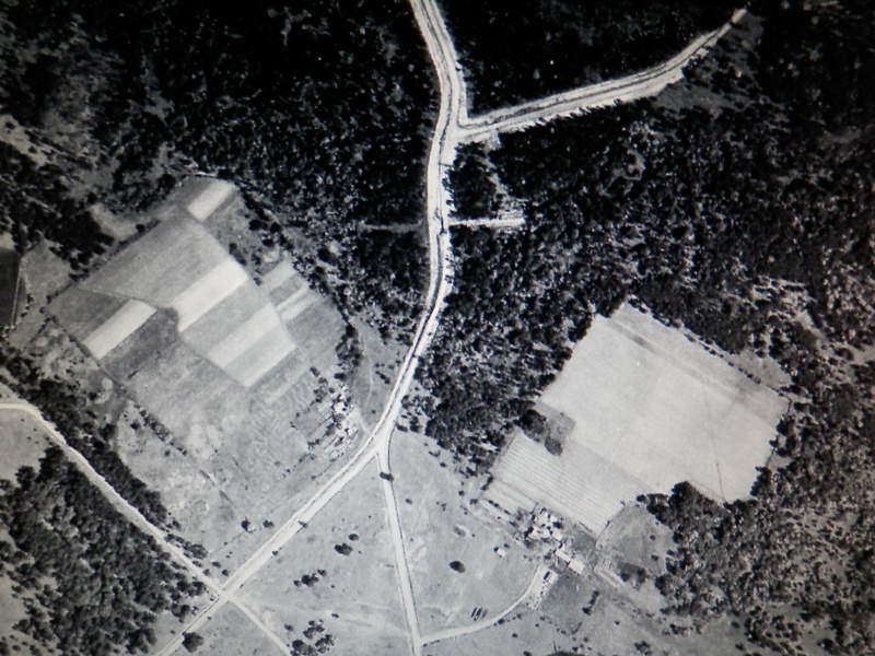
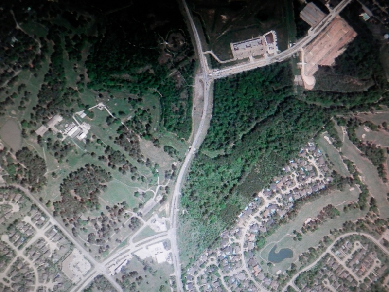
If you are traveling eastbound on Spring Cypress, the road begins to curve slightly south after Mueller, and then at the next traffic signal, you will see "Old Spring Cypress" on the left side of the road. To decipher what changed during this realignment, see the diagram below.
The drawing on the left shows Spring Cypress as it looked before the realignment. There are three distinct sharp turns in direction, all of which required traffic to slow down when negotiating the turns. All of this turning was necessary to make a single change in direction of travel from east, to southeast. The narrow brown road on the far left is Klein Cemetery Road, which merged onto the original Spring Cypress right-of-way.
The drawing on the right shows Spring Cypress after the realignment. The wider, smoother curving road is the new Spring Cypress Rd. The old road was divided into two separate roads. The section of road on the upper right was dubbed "Old Spring Cypress", which provided access to a small row of houses, but was otherwise left abandoned towards the south where it crossed a creek. The section of road on the lower left adopted two names. Mueller (running north/south), and Klein Cemetery (running east/west).
If you are standing on Klein Cemetery Road looking east, you can see that it lines up perfectly with Old Spring Cypress Rd., proving that the two roads were once part of the same alignment.
SCR 056.jpg : Mueller Rd. (part of the original Spring Cypress), facing north.
SCR 055.jpg : The crossing of Mueller & Klein Cemetery Rds., facing south from Mueller.
SCR 058.jpg : Looking east along Klein Cemetery Rd. towards Old Spring Cypress Rd. The two roads, separated by the present day Spring Cypress Rd., line up perfectly.
SCR 028.jpg : Old Spring Cypress Rd., on the north side of the new alignment, facing east.
SCR 031.jpg : Another view of Old Spring Cypress Rd., and the few houses it serves today.
SCR 032.jpg : Looking south along the original right-of-way for Spring Cypress Rd., with the newer alignment on the far right of the photo. This part of Old Spring Cypress Rd. has deteriorated badly due to lack of traffic & upkeep.
SCR 033.jpg : Further along Old Spring Cypress Rd. where it comes to an end at a creek. There was once presumably an old bridge that crossed the creek, but it has been torn down in favor of the newer bridge to the right.
SCR 035.jpg : Looking back north along Old Spring Cypress Rd. from the creek. From here, the road surface is badly decayed and poorly defined as anything but grass.
SCR 036.jpg : A close-up of the deteriorated road surface of Old Spring Cypress Rd.
THE OTHER RE-ALIGNMENT LOCATION NEAR TELGE:
The realignment at Telge Rd. was done in 2006, erasing the original intersection and relocating the Spring-Cypress intersection to the back side of the gas station, rather than in front of it. The original Spring-Cypress alignment merged smoothly onto Telge, and came to meet with the eastern half of Spring-Cypress just a few blocks north. The original intersection was turned into a big depression in the ground, and the remnant section of Spring-Cypress was turned into a dead end.
(Above photo: Google Earth images showing the intersection of Spring-Cypress with Telge near Little Cypress Creek, before (1944) and after (2014)
SCR 008.jpg : Old Spring-Cypress dead end near Telge, facing east towards Telge, 2011.
SCR 009.jpg : Old Spring-Cypress dead end near Telge, facing west along the old alignment, 2011.
May 2013a 075.jpg : A May 2013 photo approaching the Telge/Spring Cypress intersection from the west. Old road is on the left.
Aug 2014a 003.JPG : Dead end of Old Spring-Cypress Rd. near Telge, Aug. 2014.
Aug 2014a 011.JPG : Facing west from the dead end, Aug. 2014.
Aug 2014a 004.JPG : Facing east beyond the dead end where Spring-Cypress once met Telge, Aug. 2014.
Aug 2014a 005.JPG : Zooming in across the bowl towards the Telge alignment, Aug. 2014.
Aug 2014a 008.JPG : Facing south at the original location where Spring-Cypress merged with Telge, Aug. 2014.
Aug 2014a 009.JPG : Facing the Old Spring-Cypress dead end from inside the bowl, Aug. 2014.
OTHER PHOTOS OF SPRING-CYPRESS RD. BEFORE WIDENING TO FOUR LANES, DEC. 2011
SCR 013.jpg : Eastbound on Spring-Cypress from Telge.
SCR 014.jpg : Eastbound on Spring-Cypress from Telge, rounding the left curve.
SCR 015.jpg : Eastbound on Spring-Cypress approaching Louetta.
SCR 016.jpg : Eastbound on Spring-Cypress at Louetta.
SCR 017.jpg : Eastbound on Spring-Cypress past Louetta, before Grant.
SCR 018.jpg : Intersection of Spring-Cypress at Grant, facing east.
SCR 019.jpg : Eastbound on Spring-Cypress past Grant rounding a right curve.
SCR 020.jpg : Eastbound on Spring-Cypress at the entrance to North Pointe Forest community.
SCR 021.jpg : Eastbound on Spring-Cypress approaching SH-249, with Wal-Mart Supercenter on the left.
SCR 022.jpg : Eastbound on Spring-Cypress past SH-249, rounding a left curve. Not sure what this structure is, but it was here before the 1970's, something to do with a dairy farm. The road east of SH-249 has already been widened to four lanes in this photo, but everything west of 249 was still two-lanes only.
PHOTOS TAKEN DURING WIDENING IN MAY 2013
May 2013a 076.jpg : Spring-Cypress at Louetta Rd., facing east.
May 2013a 077.jpg : Eastbound on Spring-Cypress near the Lakes of Northpointe community.
May 2013a 078.jpg : Eastbound on Spring-Cypress near the Lakes of Northpointe community.
May 2013a 079.jpg : Eastbound on Spring-Cypress passing a bridge over Faulkey Gulley.
_____________________________________________________________________________________________________________________________________________
STOCKDICK SCHOOL RD.
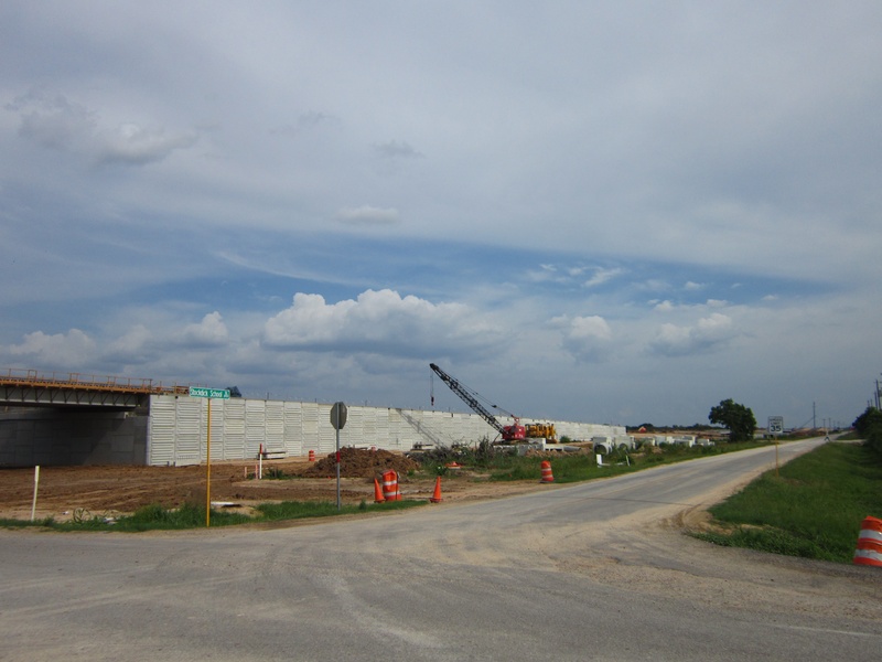
(Above photo: The original Stockdick School Rd. intersection at FM 529 during construction of the Grand Parkway, June 2012.)
Stockdick School was one of many small, one-room schoolhouses that encircled the Katy area back in its early days of settlement. It was named after a local settler named Adam Henry Stockdick, and of course the road in Katy known as Stockdick School Road was named appropriately for being the path to that particular school. The schoolhouse no longer exists, but the road remains in use today. In 2012, a part of the Grand Parkway SH-99 was built right alongside a northbound alignment of Stockdick School Road that ran to FM 529.
The new freeway and Stockdick School Rd. both intersected FM 529 very close to one another, so the north end of Stockdick School Rd. was realigned to the west, giving plenty of room for frontage roads and some required drainage infrastructure. The drainage basin was built right on top of the old north end of the road, so there is nothing left to see today, but I was fortunate enough to have captured pictures of the original Stockdick School Rd. intersection with FM 529, something that will never be seen again.
Jun 2012a 014.jpg : A link to the same photo above
Feb 2013a 021.jpg : Stockdick School Rd. near FM 529 after the realignment, Feb. 2013.
Feb 2013a 022.jpg : Facing north along what used to be the northern end of Stockdick School Rd., Feb. 2013.
Feb 2013a 024.jpg : Facing south along Stockdick School Rd. beside Grand Parkway at the site of the realignment, Feb. 2013.
________________________________________________________________________________________________________________________________________________
SUSQUEHANNAH DR.
(Above photo: An old street sign for Susquehannah placed in someone's front yard along Eldridge Parkway, Apr. 2014)
Susquehannah Drive is a forgotten neighborhood street that ran through the heart of the Tower Oaks Plaza community on the south side of Cypress-North Houston Rd. The community was formed sometime in the 1950's, and consisted of five streets, Mills, Lieder, Oralia, Susquehannah, and Mile Dr. They were tied together by a main loop drive called Morgan Dr. I don't normally include neighborhood streets in my list of abandoned and forgotten roads, but this story struck me as interesting as I have passed through the area hundreds and hundreds of times, and only recently discovered what happened just south of Cypress-North Houston and Eldridge.
Sometime in the very early 1990's, exact year not yet known, Eldridge Parkway was expanded north of FM 1960 through the Barwood community, where there was already a road segment waiting to be connected. This segment in Barwood was bordered on the north by another community, Tower Oaks Plaza. When Eldridge Parkway was finally extended north of Barwood into the older Tower Oaks Plaza, some major interruptions occurred.
A property on the southwest corner of the neighborhood on Mile Drive was consumed, as well as the southwest corner of the Morgan Dr. loop. The little street called Susquehannah, which connected with most of the streets in the neighborhood at some point, was run over by the new right of way for Eldridge Parkway. I can only imagine how weird and offending it would be to live in a quiet, rural neighborhood, and suddenly find your house on the edge of a major thoroughfare while your home street vanished into history.
As much as I looked, I could not readily find any information available online in reference to the absorption of Susquehannah Dr. The only thing you could find is an old black and white aerial image on Google Earth that shows the old street back in the days before Eldridge existed in the area. Aside from the residents who lived in the area during the Eldridge expansion, there is virtually no way of finding out about Susquehannah Dr., or the little green street sign posted in someone's front yard bearing testament to the existence of a road from another time.
PHOTOS FROM APRIL 2014
Apr 2014a 086.JPG : Facing north on West Morgan Dr. from Oralia. Susquehannah intersected Morgan just ahead on the right, across from the truck in the photo.
Apr 2014a 088.JPG : Facing south on West Morgan Dr. from Oralia.. The stub of road is where the rest of the southwest corner of Morgan used to be, but the asphalt is not originally from the road. It was later repaved by the property owner to access a nearby gate once accessible from Morgan.
Apr 2014a 090.JPG : Looking east on Oralia Dr. where Eldridge bisected the road. Across Eldridge is the rest of Oralia, and in the foreground of the photo, you can see where the road construction changed from asphalt to concrete.
Apr 2014a 087.JPG : Another photo looking east on Oralia Dr., across Eldridge Parkway.
Apr 2014a 091.JPG : This property at the corner of Eldridge and Lieder was probably one of the few that were bought out before the expansion. There is no trace of a house, but this looks to have been someone's driveway, and old aerial photos show some type of residence here.
DIAGRAMS (somewhat crude but a good explanation of what happened)
Apr 2014a 083.JPG : Tower Oaks Plaza in its original configuration.
Apr 2014a 084.JPG : Tower Oaks Plaza with Eldridge Parkway planned route outlined in orange.
Apr 2014a 085.JPG : Tower Oaks Plaza after the Eldridge Parkway expansion was completed, early 1990's.
__________________________________________________________________________________________________________________________________________________
TELGE RD.
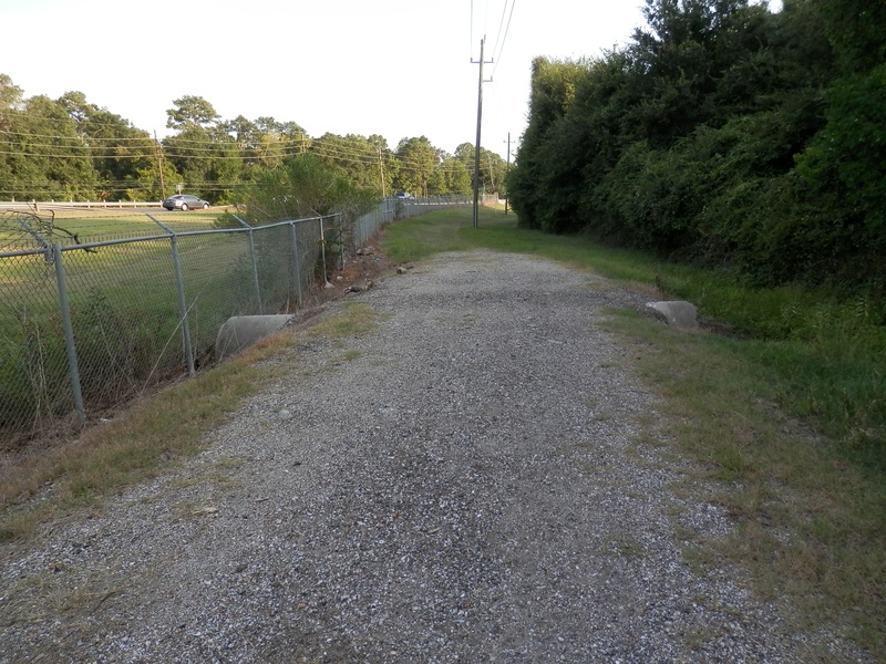
(Above photo: What may look like a simple park trail is actually part of an old alignment of Telge near Little Cypress Creek, Aug. 2014)
Telge Rd. has had several realignments done, most of which took place during the 1950's or 1960's. The history of the road itself is explained in detail on the "Other Historic Roads" page, but this chapter focuses specifically on the realignments. Heading north, we begin at the intersection with Spring-Cypress Rd.
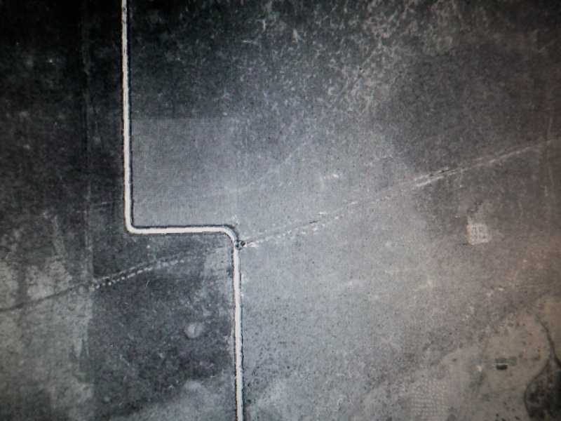
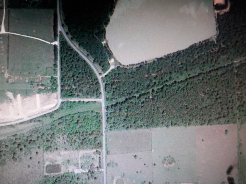
Telge has always been the point at which Spring-Cypress Rd. was divided into two halves by an offset. The only difference in this intersection is before and after 2006. Prior to 2006, the western half of Spring-Cypress used to pass the [Shell] gas station on the north. In 2006, Spring-Cypress was realigned to the south side of the gas station, creating a completely different intersection with Telge. In turn, the northern end of Telge Rd. was shortened and curved slightly to the east. Today, the original intersection of the two roads has been erased, but is located within the center of a huge depression in the land that was created. If you look around at some of the infrastructure (power lines, sewer manholes, drainage conduit), you can tell where Telge and Spring-Cypress originally met up. Further north along Telge is the intersection with the eastern half of Spring-Cypress Rd., located across from Little Cypress Creek Preserve.
The realignment at Little Cypress Creek Preserve was done a long time ago, prior to the late 1970's at least. Those of you who travel Telge to Spring-Cypress regularly might notice how wide the opening is between the tree lines on either side of the road. To the west, there is a walking trail known as Little Cypress Creek Preserve. To the east is a recently widened version of the east half of Spring-Cypress. What you may not know is that there is actually an old abandoned alignment of Telge Rd. enclosed within the fence line of the preserve. Today it is barely recognizable as anything but a gravel path on the south side of the parking lot, but if you check out old aerial imagery on Google Earth, you can see that the original right of way for Telge Rd. was located much further west than today's road. This old alignment was abandoned in the mid 20th century, but left behind plenty of evidence.
Aug 2014a 007.JPG : This is the depression or "bowl" where the original intersection once existed. To the right is the present day Telge Rd.., and the pile of rocks and overgrown shrubs on the left marks the location of the original alignment that was abandoned, Aug. 2014.
Aug 2014a 012.JPG : Part of the original Telge alignment enclosed within the fence line of Little Cypress Creek Preserve, facing south.
Aug 2014a 014.JPG : Facing north along the original alignment within the preserve. Most of the road has been grown over at this spot.
Aug 2014a 015.JPG : Close up of the old asphalt peeking through the grass.
Aug 2014a 016.JPG : Facing north along the abandoned alignment from the entrance gate to the preserve.
Traveling further north along Telge, another realignment was done, also in the 1950's or 60's, right where Grand Parkway now crosses Telge. The old road left behind after the realignment was known as Self Rd., and even that was done away with following completion of the F1 segment of Grand Parkway. The old alignment still exists, but reaches a dead end as of Summer 2014.
(Above photo: Comparison of realignment site near Grand Parkway crossing, 1944 vs. 2014)
Aug 2014a 017.JPG : Facing south near the split of new and old Telge alignments, Aug. 2014
Aug 2014a 018.JPG : Facing south along the old alignment of Telge where Grand Parkway is about to cross, Aug. 2014.
Aug 2014a 019.JPG : Facing north along the old alignment of Telge where the present day road meets up, Aug. 2014.
Aug 2014a 024.JPG : Facing north along the old alignment of Telge from the Grand Parkway construction site, Aug. 2014.
Only a few blocks north of the aforementioned Grand Parkway crossing, there was another minor realignment done near the present day intersection of Cypress Garden Dr. This is probably the oldest realignment of all the Telge realignments, dating back to the 1950's. The original right-of-way is now enclosed within private property lines, and barely noticeable to passing motorists, but if you look for it, there is evidence.
Aug 2014a 026.JPG : Facing south along the old alignment, which is now private property.
Aug 2014a 027.JPG : The split between the new and old alignments.
Aug 2014a 028.JPG : Facing north along present day Telge at Cypress Garden Dr. near the realignment.
___________________________________________________________________________________________________________________________________________________
TEXAS WESTERN NARROW GAUGE RAILROAD
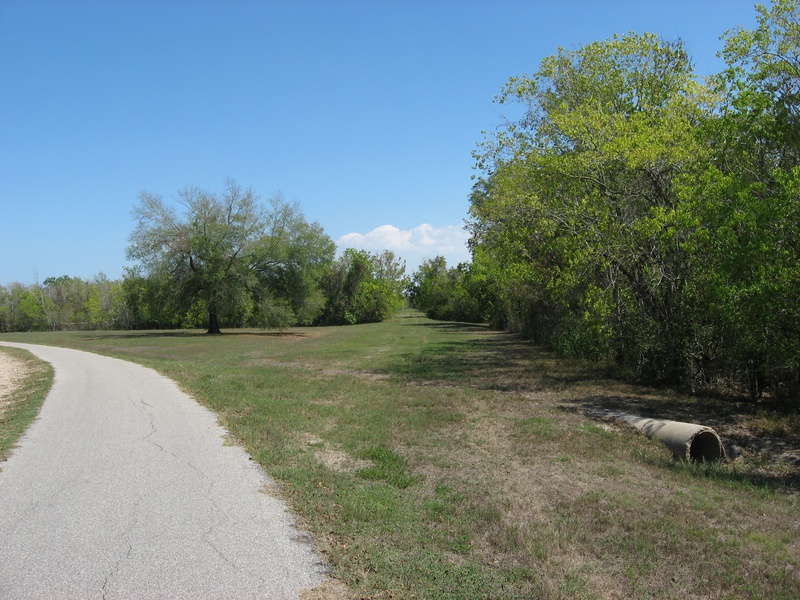
(Above photo: Facing east along the abandoned Texas Western Railroad Corridor where it intersects Barker-Clodine Rd., 2012)
The plans for a railway leading from Houston to San Antonio were already in the works as early as 1870. The railway was intended to travel west to San Antonio via Bellville, La Grange, Lockhart, and New Braunfels. On August 4th, 1870, the railway was chartered as the Western Narrow Gauge Railroad Company. In 1872, ground was broken on the corridor, though actual construction did not begin until 1875. The railroad right-of-way began in town off W. Alabama, following a straight line out west. In March 1875, the company received their first locomotive, and the charter was amended to change the name of the railroad to Texas Western Narrow Gauge Railroad Company. By 1877, the first 42 miles from Houston to Pattison, TX were complete. The company ran two locomotives, 15 freight cars, and one passenger car.
In 1881, the company changed names again to the Texas Western Railway. Another 10 mile extension of the railroad to Sealy, TX was completed. Up until this point, the railroad corridor had all the marks of a growing enterprise, but in 1893, the Missouri, Kansas & Texas (K-T) Railway built a railroad into Houston along the projected route of the Texas Western Railway, coming in from the opposite direction. This move basically put an end to any further progression by Texas Western Railway, and sealed its fate. The K-T railroad corridor is where the name of the town Katy is said to have originated, and the railroad corridor running through downtown Katy is the very same one which put an end to the Texas Western Narrow Gauge.
In 1895, the existing right-of-way for the Texas Western Narrow Gauge Railroad was sold to a man named Elijah Smith, and the railroad was said to have ceased all operation by the end of June 1896. By 1899, the railway had been abandoned entirely, and the following year the rails were removed and the corridor completely vacated.
In the early 20th century, the abandoned railroad corridor was repurposed. There was vacant right-of-way extending west from Midtown Houston all the way past Addicks-Howell Rd. into what is now the Barker Reservoir. Part of the corridor evolved into Westheimer Road, which turned south and rain directly into Alief along a road known as Alief-Houston Road (today known as West Houston Center Blvd.). Continuing west from that branch-off was a segment of abandoned railway that was turned into a crushed shell road known as Beeler, which appears to have ended at Addicks-Howell Rd. All of the remaining railroad corridor would not be used for roads, as it was going to find itself swallowed up by the boundaries of the planned Barker Reservoir.
So to clarify, Beeler was only a stretch running approximately between Addicks-Howell and Alief-Houston Roads. The grass-covered clearing inside the Barker Reservoir, which sits on the same line of latitude as Westheimer; that's all that remains of the Texas Western Narrow Gauge railroad. It makes a shallow turn to the northwest, heading for the town of Katy, but residential development has erased the remaining path once carved out by the old railroad. For the longest time, I had no idea that Westheimer Road had its beginnings as a failed railroad corridor. I find it even more interesting that there is any sign of it at all today. Everything outside the reservoir has been turned into something else; but this empty path cutting through the trees on the south side of Barker Reservoir was actually an old train corridor from the old West!
WALLER-TOMBALL RD. (FM 2920)
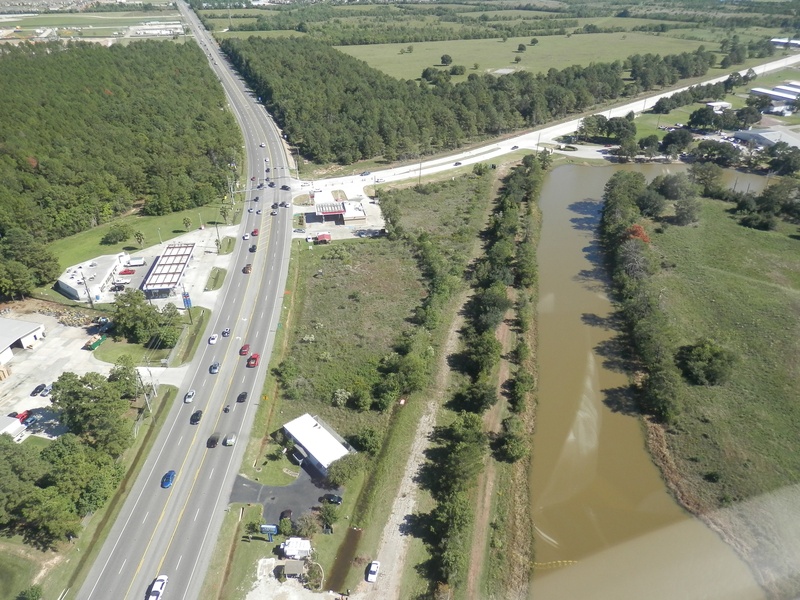
(Above photo: The intersection of FM 2920 and Stuebner-Airline, facing east, Oct. 2013. The abandoned road is visible to the left of the pond.)
Waller-Tomball Rd., also known since 1964 as FM 2920, is a rural highway that originally ran between Hempstead Rd. and FM 149 (Waller to Tomball). In 1965, the road was extended from Tomball to I-45. Waller-Tomball Rd. probably has one of the highest number of locations that saw realignments, most of which were done in the latter half of the 1960's following the FM 2920 designation. Many of the old farm road offsets and sharp turns were smoothed out in an effort to make the road a much faster and more efficient passage between Waller, Tomball, and Spring.
Today, very few of the realignment locations are visible to the naked eye, but there are a few points where the path of the original Waller-Tomball Rd. can be traced. On Google Earth's time travel feature, if you follow the road in its 1940's configuration with today's road labels overlayed, you can find at least 8-10 points of realignment, listed as follows from west to east:
-Stokes Rd.
-Hegar Rd. (a very obvious offset that remains clearly visible today)
-Becker Rd.
-Bauer Rd.
-Between Rosehill Church Rd. and Cypress Rosehill (an entire bypassed half-circle of road)
-East of Yaupon Circle in Rosehill (part of the old road is somebody's driveway)
-Telge Rd.
-Stuebner-Airline (FM 2920 actually overtook part of the original Stuebner-Airline alignment near present day Hooks airport)
Not all of these locations make good photographs, as most of them are barely recognizable on foot, but the corner of FM 2920 and Stuebner-Airline Rd. still contains a segment of the abandoned road that existed when FM 2920 took over a portion of the Stuebner-Airline alignment in the 1960's. Today, the segment is used by local street vendors on weekends to sell their goods, and on the east end, the road is completely overgrown by weeds behind a gas station (see above photo). Initially, I thought this was part of Waller-Tomball Rd., but technically, it belongs to the original Stuebner-Airline alignment, part of which was absorbed by the 1960's extension of FM 2920 from Tomball to Spring.
FM2920 001.jpg : The original point where Stuebner-Airline made a turn from an eastbound direction to the south, 2011.
FM2920 002.jpg : Facing west along the old abandoned road segment behind the gas station, 2011.
FM2920 003.jpg : Facing east along the new and old alignments from Boudreaux Rd., 2011.
FM2920 004.jpg : Facing west along the old alignment towards Boudreaux Rd., where vendors park on weekends, 2011.
FM2920 005.jpg : Facing east along the old alignment where it is overgrown with weeds, 2011.
__________________________________________________________________________________________________________________________________________________
WEST BELT DR.
Prior to the existence of the Sam Houston Tollway (Beltway 8), there was a road named West Belt Dr. than ran between Westheimer and Hammerly. It was primarily an industrial road similar to the east end of FM 529, lined with various warehouses and business parks, as well as a few service stations and corner stores. Although West Belt Dr. existed for many years before the inception of the tollway, the name itself was an ironic premonition of what would soon take its place. West Belt Dr. played nicely with the residential areas south of Interstate 10, but when the tollway was built, it cut the Memorial Bend subdivision right down the middle, and created two halves. Though we barely notice this today, it was quite a trauma for the local community who saw their main drive turn into a full blown freeway and also turned some of their thoroughfares into dead end streets.
West Belt Dr. ended at Westheimer, but just to the west was a little road called Rogerdale that continued south to Westpark Dr. Another jog to the east would meet up with Roark Rd., which also suffered the same fate as West Belt Dr.
________________________________________________________________________________________________________________________________________________________________________________________________________________________________